Area Overview for RH17 5QD
Photos of RH17 5QD
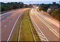
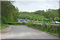
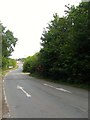
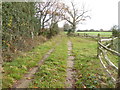
42 photos from this area
Area Information
Key information about the RH17 5QD including its size, population, and administrative classification.
- Area Type
- Postcode
- Area Size
- 18.7 hectares
- Population
- 1159
- Population Density
- 73 people/km²
House Prices in RH17 5QD
7
Properties
-
Average Sold Price
-
Lowest Price
-
Highest Price
Showing 7 properties
| Address | Type | Beds | Baths | Last Sale Price | Last Sale Date | |
|---|---|---|---|---|---|---|
| The Smithy, Beggars Bush, Brighton Road, Warninglid, RH17 5QD | Detached | - | - | - | - | |
| The Willows, London Road, Bolney, RH17 5QD | house | - | - | - | - | |
| Acorn Lodge, London Road, Bolney, RH17 5QD | house | - | - | - | - | |
| Amphibian Scaffolding, Units B1 To B9, Bolney Valley, London Road, Bolney, RH17 5QD | Industrial | - | - | - | - | |
| The Beeches, London Road, Bolney, RH17 5QD | house | - | - | - | - | |
| Amazon, Electronic Lockers, Jeremys Service Station, London Road, Bolney, RH17 5QD | Retail | - | - | - | - | |
| The Chalet, Bolney Valley, London Road, Bolney, RH17 5QD | Detached | - | - | - | - |
Energy Efficiency in RH17 5QD
Amenities
Schools
| Rank | School | Type | Entry gender | Ages |
|---|
Explore more schools in this area
Go to Schools tabDemographics
Household Size
Family (3-5 people)
most common
Accommodation Type
Houses
most common
Tenure
76
majority
Ethnic Group
White
most common
Religion
N/A
most common
Household Composition
N/A
most common
Age
47
median
Adults (30-64 years)
most common
Household Deprivation
N/A
with no deprivation
NS-SEC
47
in Lower managerial occupations
Explore more demographic insights in this area
Go to Demographics tabPlanning
Planning Constraints
- Flood RiskPremium
- Ramsar Wetland SitesPremium
- Area of Outstanding Natural BeautyPremium
- Protected Nature ReservePremium
- Protected WoodlandPremium