Area Overview for RH17 5DP
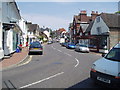
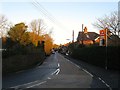
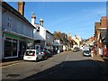
Photos of RH17 5DP
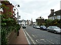
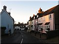
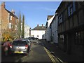
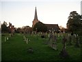
Area Information
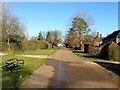
Living in RH17 5DP means residing in a specific residential cluster defined by a single postcode covering 7.9 hectares. This postcode holds a population of 1,429 people, creating a tightly knit neighbourhood with a density of 178 people per square kilometre. The area functions as a quiet residential pocket rather than a sprawling commercial zone. You will find a community where residents know their neighbours, given the small scale of the land and the focused nature of the housing development. Daily life revolves around proximity to local services and a sense of established stability. The compact size ensures that walks to local shops or public transport are short and manageable. This environment suits those who value a defined neighbourhood where the boundaries are clear and the community atmosphere is intentional. The area stands apart from larger urban centres, offering a retreat where the built environment does not overwhelm the landscape. It is a place where the focus remains on home ownership and stability rather than rapid turnover. You secure a foothold in a location where every plot and road serves the residential needs of the 1,429 current residents.
- Area Type
- Postcode
- Area Size
- 7.9 hectares
- Population
- 1429
- Population Density
- 178 people/km²
The property market in RH17 5DP is defined by stable ownership rather than rental speculation. With 76 per cent of homes occupied by their owners, this postcode cluster functions as a traditional family market. Houses comprise the primary accommodation type, meaning you will find detached or semi-detached properties suitable for families requiring space. This high level of ownership indicates that investors looking for quick rental yields will find limited opportunity here. Instead, sellers target owners who value security and permanence. The small total area of 7.9 hectares constrains the size of the transaction pool, which can help maintain prices during times of broader market fluctuation. When buying homes in RH17 5DP, you compete with motivated owners rather than landlords. The lack of private rented accommodation means fewer interruptions from tenants moving in and out frequently. This stability benefits schools and local businesses as families remain in the area for years. You can expect a market driven by people choosing where to raise a family, not by employers renting it for staff turnover. The housing stock reflects the median age of 47, with properties designed for those settling down.
House Prices in RH17 5DP
Showing 1 properties
| Address | Type | Beds | Baths | Last Sale Price | Last Sale Date | |
|---|---|---|---|---|---|---|
| The Bungalow, Warden Park School, Broad Street, Cuckfield, RH17 5DP | Detached | - | - | - | - |
Energy Efficiency in RH17 5DP
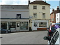
Your daily lifestyle in RH17 5DP benefits from five retail outlets situated within easy walking distance. Co-op Former, Co-op Haywards, and Sainsburys Haywards form the core of local shopping opportunities. These supermarkets provide the essential goods needed for household management without requiring a long drive. For those seeking more extensive options, Haywards Heath Railway Station offers access to a wider range of retail experiences just beyond the immediate area. Leisure and transport nodes are clustered efficiently around you. Two motorway interchange points, Horsted Keynes and Sheffield Park, serve as gateways to the wider network for long-distance travel. The area feels secure and convenient, with household needs met by the local Co-op branches and Sainsburys. You can manage weekly food shopping and household errands from the comfort of the postcode cluster. The presence of multiple railway stations caters to both commuters and leisure travellers. Residents can walk to Co-op Haywards for quick trips or drive to Sainsburys for larger purchases. This mix of local convenience stores and major supermarkets ensures you never lack for essentials. The rail links provide a flexible Escalation for longer journeys to Brighton or London.
Amenities
Schools
Families in RH17 5DP have access to a clear educational route within a short distance. Warden Park School serves as the primary option for younger children, providing early education for the community. As children mature, they progress to Warden Park Secondary Academy, which holds a 'good' Ofsted rating. This school offers secondary education covering the ages and needs of adolescents living in the postcode. The presence of both a primary and a secondary academy within the vicinity means families do not need to travel far to secure schooling for their children. You can plan your move around these institutions without navigating a complex search for distant provision. The 'good' rating of Warden Park Secondary Academy suggests a standard of education that meets national requirements and often exceeds them. For those prioritising education, this cluster of schools offers a convenient solution. The proximity of these facilities to the residential cluster ensures that daily commutes for students are minimal. Parents in RH17 5DP can rely on local provisions for both early years and secondary phases of learning.
| Rank | School | Type | Entry gender | Ages |
|---|
Explore more schools in this area
Go to Schools tabDemographics
The community in RH17 5DP skews older than the national average, with a median age of 47 years. Most common age ranges fall between 30 and 64 years, indicating a household composition focused on families, couples, and established singles rather than young professionals. Home ownership stands at 76 per cent, a figure that underscores the stability of the people living here. This high rate reflects a market where people buy into RH17 5DP with the intention of staying long-term. It is an area dominated by houses, consistent with the demographic profile of individuals seeking space and security. The predominant ethnic group is White, mirroring broader trends in many county towns and their suburbs. While specific deprivation data is not provided in the current records, the high home ownership rate suggests a settled population with significant local investment. You are looking at a neighbourhood where residents have put down roots. The age profile removes the typical chaos of student housing or transient renting that plagues university towns. It is a mature environment where decision-making is deliberate and the social fabric is woven from decades of local presence.
Household Size
Accommodation Type
Tenure
Ethnic Group
Religion
Household Composition
Age
Household Deprivation
NS-SEC
Explore more demographic insights in this area
Go to Demographics tabPlanning
Planning Constraints
- Flood RiskPremium
- Ramsar Wetland SitesPremium
- Area of Outstanding Natural BeautyPremium
- Protected Nature ReservePremium
- Protected WoodlandPremium