Area Overview for RH16 3JF
Photos of RH16 3JF

Area Information
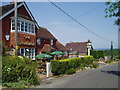
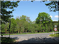
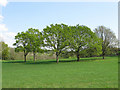
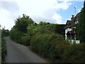
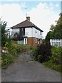
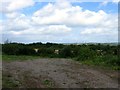
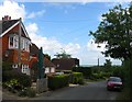
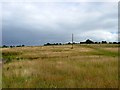
Living in the RH16 3JF postcode presents a distinct residential experience defined by its compact size and established character. This specific cluster covers just 9,378 square metres, creating a tightly knit community rather than a sprawling neighbourhood. The area supports a population of 1,405 residents, resulting in a very high density figure of 149,818 people per square kilometre. Despite these tight boundaries, life here focuses on established housing rather than transient development. The demographic profile indicates an older average age of 47, with adults between 30 and 64 years forming the core group. Most residents have lived in their homes for a significant period, evidenced by a 93% home ownership rate. The physical environment consists entirely of houses, offering a standalone living arrangement rare in the modern market. With no protected green spaces or national park constraints defining the immediate vicinity, the area prioritises built residential density. Daily life revolves around central access to transport hubs and local retail, making it a practical choice for those seeking proximity to Hornsworth Heath and nearby train stations.
- Area Type
- Postcode
- Area Size
- 9378 m²
- Population
- 1405
- Population Density
- 2646 people/km²
The property market in RH16 3JF is defined by a severe lack of rental inventory and a near-total reliance on owner-occupiers. A staggering 93% of the housing stock is owner-occupied, meaning the rental sector is virtually non-existent in this specific cluster of 9,378 square metres. This high ownership rate reflects an area built for permanent settlement rather than short-term accommodation. You will find a collection of houses as the primary accommodation type, aligning with traditional suburban standards rather than modern urban living formats. Finding a rental property here would be exceptionally difficult due to these market dynamics. Potential buyers should view this high ownership figure as a sign of a stable, settled community where properties change hands infrequently. If you are looking to rent, your search will naturally expand to surrounding postcodes in the Haywards Heath or Burgess Hill catchment areas. For buyers, securing a home in the housing market here offers a chance to join one of the most established neighbourhoods in the immediate vicinity.
House Prices in RH16 3JF
Showing 14 properties
| Address | Type | Beds | Baths | Last Sale Price | Last Sale Date | |
|---|---|---|---|---|---|---|
| 6 Orchid Park, Haywards Heath, RH16 3JF | house | - | - | £610,000 | Jan 2025 | |
| 2 Orchid Park, Haywards Heath, RH16 3JF | Detached | 3 | 1 | £455,000 | Aug 2024 | |
| 1 Orchid Park, Haywards Heath, RH16 3JF | Detached | 4 | - | £465,000 | Oct 2020 | |
| 8 Orchid Park, Haywards Heath, RH16 3JF | Detached | 4 | - | £495,000 | Jul 2016 | |
| 14 Orchid Park, Haywards Heath, RH16 3JF | Detached | 4 | - | £425,000 | Jul 2014 | |
| 12 Orchid Park, Haywards Heath, RH16 3JF | Detached | 4 | 2 | £340,000 | Jul 2013 | |
| 18 Orchid Park, Haywards Heath, RH16 3JF | Detached | - | - | £290,000 | May 2007 | |
| 16 Orchid Park, Haywards Heath, RH16 3JF | Detached | - | - | £327,000 | Dec 2006 | |
| 4 Orchid Park, Haywards Heath, RH16 3JF | Detached | - | - | £273,000 | Nov 2006 | |
| 3 Orchid Park, Haywards Heath, RH16 3JF | Detached | - | - | £250,000 | May 2003 |
Energy Efficiency in RH16 3JF
Practical convenience defines daily life for residents of RH16 3JF. Your nearest shopping options are dominated by three major supermarkets: Tesco Haywards Heath, Morrisons Daily Haywards, and The Southern Co-operative Co. These retailers provide a comprehensive range of groceries and household essentials. For rail travel, you have access to five nearby stations, including Haywards Heath Railway Station, Wivelsfield Railway Station, and Burgess Hill Railway Station. These stations serve as vital gateways for commuters. Metro connections are available from two points, Sheffield Park and Horsted Keynes, extending your travel radius beyond standard train lines. The cluster is small enough that these amenities are within easy reach. You do not need to travel far to stock up on food or catch a train for work or leisure. This proximity to major retailers and transport hubs forms the backbone of a efficient, car-independent lifestyle for some residents.
Amenities
Schools
Families considering homes in RH16 3JF will find two nearby primary academies under direct management. Northlands Wood Community Primary School and Northlands Wood Primary Academy are the key educational institutions located within practical reach. Both institutions are primary schools, meaning there are no secondary schools, colleges, or universities listed for the immediate cluster. This configuration suggests the area serves established families with younger children. Parents will need to rely on transport links to reach broader non-statutory education options further away. The presence of both a community school and an academy covering the Northlands Wood designation indicates a localised educational focus. The proximity of two institutions with similar names implies a strong local educational infrastructure dedicated to the younger generation.
| Rank | School | Type | Entry gender | Ages |
|---|
Explore more schools in this area
Go to Schools tabDemographics
The community within RH16 3JF reflects a mature and settled population. The median age of 47 points to a neighbourhood split between mid-life professionals and those approaching retirement. Over 93% of homes are owner-occupied, indicating a high level of stability and long-term residency. Households are dominated by families and couples with children, as well as empty nesters, rather than young singles or students. The accommodation stock is exclusively houses, meaning you will find detached, semi-detached, or terraced properties rather than urban flats or converted apartments. Diversity within the immediate cluster is low, with White residents forming the predominant ethnic group. This contrasts with many larger UK cities where mixed demographics are common. The high ownership percentage suggests that residents are deeply embedded in the local fabric, preferring to buy into their community rather than rent temporarily. This stability often contributes to stronger neighbourly connections and consistent local management of shared spaces.
Household Size
Accommodation Type
Tenure
Ethnic Group
Religion
Household Composition
Age
Household Deprivation
NS-SEC
Explore more demographic insights in this area
Go to Demographics tabPlanning
Planning Constraints
- Flood RiskPremium
- Ramsar Wetland SitesPremium
- Area of Outstanding Natural BeautyPremium
- Protected Nature ReservePremium
- Protected WoodlandPremium