Area Overview for RH16 2LG
Photos of RH16 2LG
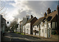
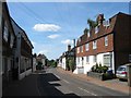
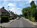
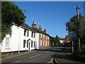
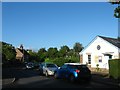
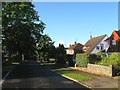
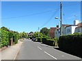
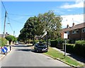
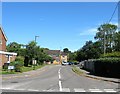
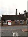
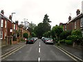
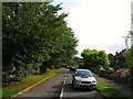
99 photos from this area
Area Information
Key information about the RH16 2LG including its size, population, and administrative classification.
- Area Type
- Postcode
- Area Size
- 1.1 hectares
- Population
- 2058
- Population Density
- 1217 people/km²
House Prices in RH16 2LG
17
Properties
£533,950
Average Sold Price
£272,500
Lowest Price
£720,000
Highest Price
Showing 17 properties
| Address | Type | Beds | Baths | Last Sale Price | Last Sale Date | |
|---|---|---|---|---|---|---|
| Linden Chalet, Lewes Road, Lindfield, RH16 2LG | house | 2 | 1 | £640,000 | Mar 2025 | |
| Clover, Lewes Road, Lindfield, RH16 2LG | Detached | 4 | 1 | £697,000 | Apr 2024 | |
| Rose Cottage, Lewes Road, Lindfield, RH16 2LG | house | 3 | 1 | £540,000 | Sep 2022 | |
| Appledore Cottage, Lewes Road, Lindfield, RH16 2LG | house | - | - | £685,000 | Jul 2022 | |
| Wits End, Lewes Road, Lindfield, RH16 2LG | house | 4 | - | £505,000 | Jun 2021 | |
| Selby Cottage, Lewes Road, Lindfield, RH16 2LG | Semi-detached | 4 | 2 | £720,000 | Oct 2019 | |
| Greenacres, Lewes Road, Lindfield, RH16 2LG | house | 3 | - | £445,000 | Feb 2018 | |
| The Palms, Lewes Road, Lindfield, RH16 2LG | Bungalow | 3 | 2 | £560,000 | May 2014 | |
| Lyndons, Lewes Road, Lindfield, RH16 2LG | house | - | - | £272,500 | Apr 2003 | |
| Greys, Lewes Road, Lindfield, RH16 2LG | Semi-detached | - | - | £275,000 | Jul 2002 |
Page 1 of 2
Energy Efficiency in RH16 2LG
Amenities
Schools
| Rank | School | Type | Entry gender | Ages |
|---|
Explore more schools in this area
Go to Schools tabDemographics
Household Size
Two person
most common
Accommodation Type
Houses
most common
Tenure
68
majority
Ethnic Group
White
most common
Religion
N/A
most common
Household Composition
N/A
most common
Age
47
median
Adults (30-64 years)
most common
Household Deprivation
N/A
with no deprivation
NS-SEC
46
in Lower managerial occupations
Explore more demographic insights in this area
Go to Demographics tabPlanning
Planning Constraints
- Flood RiskPremium
- Ramsar Wetland SitesPremium
- Area of Outstanding Natural BeautyPremium
- Protected Nature ReservePremium
- Protected WoodlandPremium