Area Overview for RH16 2BS
Photos of RH16 2BS
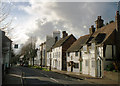
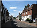
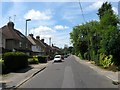
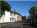
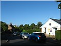
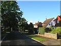
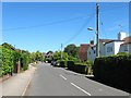
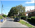
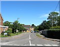
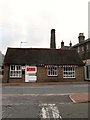
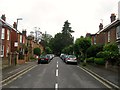
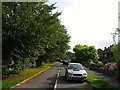
99 photos from this area
Area Information
Key information about the RH16 2BS including its size, population, and administrative classification.
- Area Type
- Postcode
- Area Size
- 2.1 hectares
- Population
- 1905
- Population Density
- 2512 people/km²
House Prices in RH16 2BS
20
Properties
£725,787
Average Sold Price
£369,950
Lowest Price
£940,000
Highest Price
Showing 20 properties
| Address | Type | Beds | Baths | Last Sale Price | Last Sale Date | |
|---|---|---|---|---|---|---|
| 16 Pickers Green, Lindfield, RH16 2BS | Detached | 4 | 2 | £917,500 | Sep 2025 | |
| 2 Pickers Green, Lindfield, RH16 2BS | house | 4 | 3 | £940,000 | Mar 2025 | |
| 17 Pickers Green, Lindfield, RH16 2BS | house | - | - | £930,000 | Jul 2022 | |
| 4 Pickers Green, Lindfield, RH16 2BS | house | - | - | £870,000 | Apr 2022 | |
| Oak Tree House, 5 Pickers Green, Lindfield, RH16 2BS | house | - | - | £915,000 | Dec 2021 | |
| 1 Pickers Green, Lindfield, RH16 2BS | house | - | - | £725,000 | Jul 2019 | |
| 10 Pickers Green, Lindfield, RH16 2BS | house | - | - | £700,000 | May 2018 | |
| 13 Pickers Green, Lindfield, RH16 2BS | house | - | - | £780,000 | Oct 2017 | |
| 9 Pickers Green, Lindfield, RH16 2BS | Detached | 3 | - | £450,000 | Apr 2014 | |
| 12 Pickers Green, Lindfield, RH16 2BS | Detached | 4 | - | £612,000 | Nov 2013 |
Page 1 of 2
Energy Efficiency in RH16 2BS
Amenities
Schools
| Rank | School | Type | Entry gender | Ages |
|---|
Explore more schools in this area
Go to Schools tabDemographics
Household Size
Family (3-5 people)
most common
Accommodation Type
Houses
most common
Tenure
87
majority
Ethnic Group
White
most common
Religion
N/A
most common
Household Composition
N/A
most common
Age
47
median
Adults (30-64 years)
most common
Household Deprivation
N/A
with no deprivation
NS-SEC
55
in Lower managerial occupations
Explore more demographic insights in this area
Go to Demographics tabPlanning
Planning Constraints
- Flood RiskPremium
- Ramsar Wetland SitesPremium
- Area of Outstanding Natural BeautyPremium
- Protected Nature ReservePremium
- Protected WoodlandPremium