Area Overview for RH16 1SJ
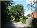
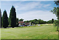
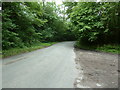
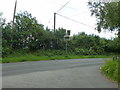
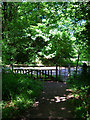
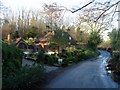
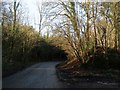
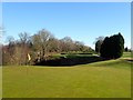
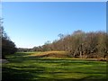
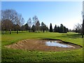
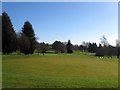
Photos of RH16 1SJ
Area Information
Living in RH16 1SJ offers a specific residential experience within a small cluster that covers just 33.2 hectares. This compact area houses 1,811 people, setting it apart from broader neighbourhoods through its focused scale and intense residential density of 5,450 people per square kilometre. The postcode serves as a distinct pocket of habitation where daily life moves at a deliberately slower pace, yet it remains functionally connected to the wider region via nearby transport links. You will find this environment defined by its quiet, domestic nature rather than commercial noise or high-density congestion. The sheer concentration of residents within this small footprint creates a tight-knit geographical unit, despite the population being relatively modest by national standards. This specific location avoids the sprawl of larger urban extensions, instead offering a contained living space where boundaries are clearly defined by the surrounding landscape and infrastructure.
- Area Type
- Postcode
- Area Size
- 33.2 hectares
- Population
- 1811
- Population Density
- 2527 people/km²
The property market in RH16 1SJ is defined by its status as a predominantly owner-occupied zone rather than a landlord-dominated rental hub. With 83% of homes owned by residents, the area offers security for buyers looking to settle permanently without the uncertainty of tenancy agreements. The accommodation type is exclusively houses, which appeals to families seeking gardens, larger plots, and traditional layouts common in the countryside fringe. You are not competing with the rental sector for stock here; the inventory is fixed in the hands of existing owners. This concentration of homeownership often results in slower transaction cycles as sellers may be less eager to move, providing potential buyers with careful consideration opportunities. The housing stock caters specifically to those who value space and privacy, consistent with the small-area, high-density rural character of the postcode. Buying here means joining a community where property is a legacy asset, not just a short-term investment vehicle.
House Prices in RH16 1SJ
Showing 33 properties
| Address | Type | Beds | Baths | Last Sale Price | Last Sale Date | |
|---|---|---|---|---|---|---|
| Sundial House, Roundwood Lane, Lindfield, RH16 1SJ | Detached | 4 | 2 | £1,250,000 | Jun 2025 | |
| Oakwood, Roundwood Lane, Lindfield, RH16 1SJ | house | - | - | £1,350,000 | Jul 2022 | |
| Linksway, Roundwood Lane, Lindfield, RH16 1SJ | house | 5 | - | £1,300,000 | Jun 2021 | |
| Corner Cottage, Roundwood Lane, Lindfield, RH16 1SJ | house | 4 | 2 | £920,000 | Apr 2021 | |
| Lincoln Lodge, Roundwood Lane, Lindfield, RH16 1SJ | house | 4 | - | £980,000 | Jul 2019 | |
| Farthings, Roundwood Lane, Lindfield, RH16 1SJ | Detached | 5 | 2 | £1,180,000 | Jun 2019 | |
| Orchard House, Roundwood Lane, Lindfield, RH16 1SJ | Bungalow | - | - | £1,390,000 | Mar 2018 | |
| Woodridge House, Roundwood Lane, Lindfield, RH16 1SJ | Detached | 5 | 3 | £1,300,000 | Nov 2017 | |
| Craigmore, Roundwood Lane, Lindfield, RH16 1SJ | house | - | - | £945,000 | Sep 2017 | |
| Greenwoods, Roundwood Lane, Lindfield, RH16 1SJ | house | - | - | £1,315,000 | Sep 2017 |
Energy Efficiency in RH16 1SJ
Your daily leisure and shopping routine in RH16 1SJ remains convenient thanks to several nearby amenities within practical reach. You can visit Sainsburys Haywards, Spar, and Waitrose Haywards for your grocery and household needs, ensuring you have top-tier retail options close by without needing a long commute. Rail travel is equally accessible, with Haywards Heath Railway Station, Balcombe Railway Station, and Wivelsfield Railway Station all nearby, offering efficient links to broader transport networks. Metro connections are also available via Horsted Keynes and Sheffield Park, providing further flexibility for your travel plans. This blend of major supermarkets and multiple railway stations means you have access to great shopping and easy regional access without leaving your immediate neighbourhood. Living in this area, you balance the tranquility of a small post code with the practical advantages of established retail and transport hubs right on your doorstep.
Amenities
Schools
| Rank | School | Type | Entry gender | Ages |
|---|
Explore more schools in this area
Go to Schools tabDemographics
The community character of RH16 1SJ is shaped overwhelmingly by a mature population with a median age of 47 years. Most households fall into the adult bracket between 30 and 64 years old, indicating a neighbourhood dominated by established families, empty nesters, and active retirees. This age profile suggests an area where stability reigns and long-term residents form the social backbone. Homeownership is exceptionally high at 83%, meaning the vast majority of the 1,811 residents own their homes outright rather than renting. Accommodation consists almost entirely of houses, reflecting a preference for standalone or semi-detached living over flats or bungalows. The predominant ethnic group is White, aligning with the broader demographic trends of many suburban English clusters. With such high ownership rates and a stable age group, the area likely fosters a quiet, neighbourly atmosphere where residents have deep roots in the community.
Household Size
Accommodation Type
Tenure
Ethnic Group
Religion
Household Composition
Age
Household Deprivation
NS-SEC
Explore more demographic insights in this area
Go to Demographics tabPlanning
Planning Constraints
- Flood RiskPremium
- Ramsar Wetland SitesPremium
- Area of Outstanding Natural BeautyPremium
- Protected Nature ReservePremium
- Protected WoodlandPremium