Area Overview for RH16 1SF
Photos of RH16 1SF
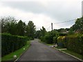

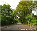
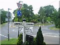
60 photos from this area
Area Information
Key information about the RH16 1SF including its size, population, and administrative classification.
- Area Type
- Postcode
- Area Size
- 2.1 hectares
- Population
- 1811
- Population Density
- 2527 people/km²
House Prices in RH16 1SF
13
Properties
£814,625
Average Sold Price
£247,000
Lowest Price
£1,275,000
Highest Price
Showing 13 properties
| Address | Type | Beds | Baths | Last Sale Price | Last Sale Date | |
|---|---|---|---|---|---|---|
| Oak Lodge, 15 Brook Lane, Lindfield, RH16 1SF | house | - | - | £1,125,000 | Jun 2024 | |
| 21 Brook Lane, Lindfield, RH16 1SF | house | 4 | - | £1,275,000 | Nov 2023 | |
| 17 Brook Lane, Lindfield, RH16 1SF | house | - | - | £830,000 | Jan 2021 | |
| 5 Brook Lane, Lindfield, RH16 1SF | house | - | - | £835,000 | Oct 2018 | |
| 25 Brook Lane, Lindfield, RH16 1SF | Detached | 4 | - | £925,000 | Mar 2016 | |
| 13 Brook Lane, Lindfield, RH16 1SF | house | 4 | - | £715,000 | Aug 2012 | |
| 27 Brook Lane, Lindfield, RH16 1SF | Detached | - | - | £565,000 | Jul 2002 | |
| 11 Brook Lane, Lindfield, RH16 1SF | Detached | - | - | £247,000 | Jan 1997 | |
| 1 Brook Lane, Lindfield, RH16 1SF | Detached | - | - | - | - | |
| 19 Brook Lane, Lindfield, RH16 1SF | Detached | - | - | - | - |
Page 1 of 2
Energy Efficiency in RH16 1SF
Amenities
Schools
| Rank | School | Type | Entry gender | Ages |
|---|
Explore more schools in this area
Go to Schools tabDemographics
Household Size
Family (3-5 people)
most common
Accommodation Type
Houses
most common
Tenure
83
majority
Ethnic Group
White
most common
Religion
N/A
most common
Household Composition
N/A
most common
Age
47
median
Adults (30-64 years)
most common
Household Deprivation
N/A
with no deprivation
NS-SEC
54
in Lower managerial occupations
Explore more demographic insights in this area
Go to Demographics tabPlanning
Planning Constraints
- Flood RiskPremium
- Ramsar Wetland SitesPremium
- Area of Outstanding Natural BeautyPremium
- Protected Nature ReservePremium
- Protected WoodlandPremium