Area Overview for RH15 9XL
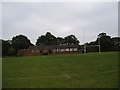
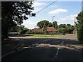
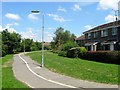
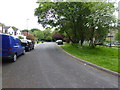
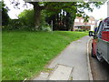
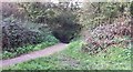
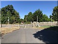
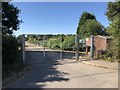
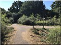
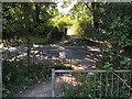
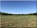
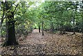
Photos of RH15 9XL
Area Information
Living in RH15 9XL offers a view of a very compact residential cluster defined by its precise boundaries. This postcode covers just 4,666 square metres of land, meaning the environment is tightly packed with residents. You will find a population of 1,615 people concentrated within this small footprint, creating a high concentration of neighbours in a limited space. The area sits within England and functions as a distinct pocket of housing rather than a sprawling suburb. Daily life here revolves around the immediate surroundings because distances between homes and local services are short. The intensity of the population density is significant for anyone considering moving into this specific postal code, as you will be in close proximity to many households. This setup suits those who value a defined, boundary-free living space over large estate grounds. You are not buying into a vague region but a specific, measurable point on the map. The community character is shaped entirely by this small, self-contained group of residents. Understanding these physical dimensions helps you grasp the true scale of life in RH15 9XL before you view available homes.
- Area Type
- Postcode
- Area Size
- 4666 m²
- Population
- Not available
- Population Density
- Not available
The property market in RH15 9XL is characterised by a predominantly owner-occupied sector where stability outweighs rental demand. You will find that 87 per cent of residents are homeowners, which restricts the supply of available rental properties and reduces turnover in the market. The stock consists almost entirely of houses, a fact that defines the look and feel of the streets in this postcode. If you are looking at homes in RH15 9XL, expect detached or semi-detached structures rather than purpose-built apartment blocks or urban flats. This market composition appeals to buyers seeking houses with private exteriors and gardens, fitting the preferences of the middle-aged majority. First-time buyers may face competition because the high ownership rate implies many sellers are looking to downsize or consolidate assets rather than rent out. Leasehold properties or shared ownership schemes are not evident in the strict demographics of this small area. Your competition will likely come from other adults in the 30 to 64 age bracket who have the financial means and desire of permanent ownership. The limited land size of 4,666 square metres further constrains new developments, meaning most homes on the market will have stood for a considerable number of years.
House Prices in RH15 9XL
Showing 6 properties
| Address | Type | Beds | Baths | Last Sale Price | Last Sale Date | |
|---|---|---|---|---|---|---|
| Sakkara, 5 Shelley Wood, Burgess Hill, RH15 9XL | Detached | 5 | 2 | £650,000 | Jul 2020 | |
| 1 Shelley Wood, Burgess Hill, RH15 9XL | Detached | 5 | 4 | £647,500 | Jul 2017 | |
| 3 Shelley Wood, Burgess Hill, RH15 9XL | Detached | - | - | £268,000 | Jun 2001 | |
| 4 Shelley Wood, Burgess Hill, RH15 9XL | Detached | - | - | £198,000 | Jul 1998 | |
| 2 Shelley Wood, Burgess Hill, RH15 9XL | Detached | 3 | - | £79,950 | Nov 1996 | |
| 15 Gatehouse Lane, Burgess Hill, RH15 9XL | Detached | - | - | - | - |
Energy Efficiency in RH15 9XL
Your daily lifestyle in RH15 9XL is shaped by the immediate availability of retail and transport links within practical reach. You have access to five notable retail sites including the prestigious Tesco Burgess and the local Spar Chandlers, ensuring your grocery and shopping needs are met without a long drive. Convenience is a priority here as these stores are located just steps away from many homes in this cluster. For commuters, there are five key railway stations nearby, including Burgess Hill Railway Station, Wivelsfield Railway Station, and Hassocks Railway Station. These stations provide the necessary links to larger employment hubs or other parts of the country. The combination of a major supermarket and railway access within close proximity creates a functional living environment. You do not need a private car to manage basic errands because the rail network and local shops are integrated into the daily routine. The residential nature of the cluster means these amenities serve a quiet population rather than a high-traffic commercial zone. Living in RH15 9XL means balancing the convenience of local services with the tranquility of a house-only neighbourhood.
Amenities
Schools
| Rank | School | Type | Entry gender | Ages |
|---|
Explore more schools in this area
Go to Schools tabDemographics
The community in RH15 9XL is dominated by established adults with a median age of 47 years. Most residents fall into the 30 to 64 years age range, indicating a stable, working-age population without a large influx of children or elderly residents. You will encounter a society where homeownership is the standard, with 87 per cent of households owning their properties outright. This high ownership rate suggests a settled community where families or couples have put down roots over time. The accommodation type is exclusively houses, meaning you are not looking at flats or terraced properties in this specific square mile. This housing style aligns with the preferences of the older, owner-occupying demographic that forms the bulk of the population. Ethnic diversity is present but the predominant ethnic group remains White, reflecting the traditional demographic profile of the wider region. For those searching for schools near RH15 9XL, the age profile suggests a number of families with young children attending local institutions. The demographic structure paints a picture of a mature, quiet neighbourhood rather than a vibrant area of transient energy or rapid turnover.
Household Size
Accommodation Type
Tenure
Ethnic Group
Religion
Household Composition
Age
Household Deprivation
NS-SEC
Explore more demographic insights in this area
Go to Demographics tabPlanning
Planning Constraints
- Flood RiskPremium
- Ramsar Wetland SitesPremium
- Area of Outstanding Natural BeautyPremium
- Protected Nature ReservePremium
- Protected WoodlandPremium