Area Overview for RH15 9TE
Photos of RH15 9TE
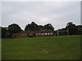
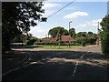
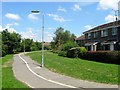
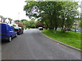
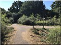
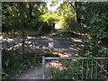
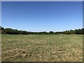
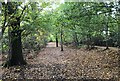
57 photos from this area
Area Information
Key information about the RH15 9TE including its size, population, and administrative classification.
- Area Type
- Postcode
- Area Size
- 1.6 hectares
- Population
- 1173
- Population Density
- 4127 people/km²
House Prices in RH15 9TE
37
Properties
£140,555
Average Sold Price
£58,000
Lowest Price
£320,000
Highest Price
Showing 37 properties
| Address | Type | Beds | Baths | Last Sale Price | Last Sale Date | |
|---|---|---|---|---|---|---|
| 61 Denham Road, Burgess Hill, RH15 9TE | house | - | - | £320,000 | Feb 2022 | |
| 49 Denham Road, Burgess Hill, RH15 9TE | house | 2 | - | £175,000 | Jun 2013 | |
| 51 Denham Road, Burgess Hill, RH15 9TE | house | - | - | £173,000 | Sep 2007 | |
| 23 Denham Road, Burgess Hill, RH15 9TE | Semi-detached | - | - | £185,000 | May 2005 | |
| 65 Denham Road, Burgess Hill, RH15 9TE | Semi-detached | - | - | £126,050 | May 2002 | |
| 55 Denham Road, Burgess Hill, RH15 9TE | Semi-detached | 4 | 1 | £113,250 | Apr 2002 | |
| 63 Denham Road, Burgess Hill, RH15 9TE | Terraced | - | - | £105,000 | Jul 2001 | |
| 25 Denham Road, Burgess Hill, RH15 9TE | Terraced | - | - | £90,000 | May 2000 | |
| 5 Denham Road, Burgess Hill, RH15 9TE | house | - | - | £60,250 | Nov 1997 | |
| 67 Denham Road, Burgess Hill, RH15 9TE | Semi-detached | - | - | £58,000 | Mar 1997 |
Page 1 of 4
Energy Efficiency in RH15 9TE
Amenities
Schools
| Rank | School | Type | Entry gender | Ages |
|---|
Explore more schools in this area
Go to Schools tabDemographics
Household Size
Family (3-5 people)
most common
Accommodation Type
Houses
most common
Tenure
56
majority
Ethnic Group
White
most common
Religion
N/A
most common
Household Composition
N/A
most common
Age
47
median
Adults (30-64 years)
most common
Household Deprivation
N/A
with no deprivation
NS-SEC
26
in Lower managerial occupations
Explore more demographic insights in this area
Go to Demographics tabPlanning
Planning Constraints
- Flood RiskPremium
- Ramsar Wetland SitesPremium
- Area of Outstanding Natural BeautyPremium
- Protected Nature ReservePremium
- Protected WoodlandPremium