Area Overview for RH15 9HJ
Photos of RH15 9HJ
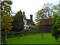
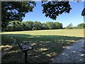
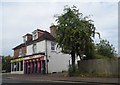
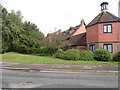
38 photos from this area
Area Information
Key information about the RH15 9HJ including its size, population, and administrative classification.
- Area Type
- Postcode
- Area Size
- 5884 m²
- Population
- 1416
- Population Density
- 2162 people/km²
House Prices in RH15 9HJ
9
Properties
£368,483
Average Sold Price
£157,000
Lowest Price
£600,000
Highest Price
Showing 9 properties
| Address | Type | Beds | Baths | Last Sale Price | Last Sale Date | |
|---|---|---|---|---|---|---|
| 274 Chanctonbury Road, Burgess Hill, RH15 9HJ | Retail | 3 | - | £600,000 | Nov 2022 | |
| 272 Chanctonbury Road, Burgess Hill, RH15 9HJ | Detached | 3 | 1 | £403,000 | Mar 2019 | |
| 266 Chanctonbury Road, Burgess Hill, RH15 9HJ | house | 3 | 1 | £442,900 | Jan 2019 | |
| 270 Chanctonbury Road, Burgess Hill, RH15 9HJ | Detached | 3 | - | £300,000 | Nov 2013 | |
| 262 Chanctonbury Road, Burgess Hill, RH15 9HJ | Detached | - | - | £308,000 | Oct 2006 | |
| 276 Chanctonbury Road, Burgess Hill, RH15 9HJ | Detached | 3 | 2 | £157,000 | Jun 2000 | |
| 264 Chanctonbury Road, Burgess Hill, RH15 9HJ | Detached | 3 | - | - | - | |
| 278 Chanctonbury Road, Burgess Hill, RH15 9HJ | house | - | - | - | - | |
| 268 Chanctonbury Road, Burgess Hill, RH15 9HJ | Detached | - | - | - | - |
Energy Efficiency in RH15 9HJ
Amenities
Schools
| Rank | School | Type | Entry gender | Ages |
|---|
Explore more schools in this area
Go to Schools tabDemographics
Household Size
Two person
most common
Accommodation Type
Houses
most common
Tenure
94
majority
Ethnic Group
White
most common
Religion
N/A
most common
Household Composition
N/A
most common
Age
47
median
Adults (30-64 years)
most common
Household Deprivation
N/A
with no deprivation
NS-SEC
38
in Lower managerial occupations
Explore more demographic insights in this area
Go to Demographics tabPlanning
Planning Constraints
- Flood RiskPremium
- Ramsar Wetland SitesPremium
- Area of Outstanding Natural BeautyPremium
- Protected Nature ReservePremium
- Protected WoodlandPremium