Area Overview for RH15 9FG
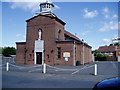
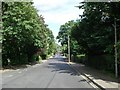
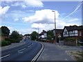
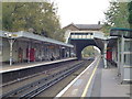
Photos of RH15 9FG
Area Information
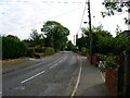
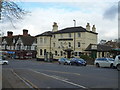
RH15 9FG is a residential postcode defined by a compact cluster of homes with a total population of 1,773 individuals. This specific location represents a quiet corner of the Burgess Hill area, where life moves at a steady pace without the noise of major city centres. The settlement functions as a self-contained community, primarily serving families and established residents rather than transient workers or students. Daily life here revolves around proximity to key local services and easy access to the wider network of the South Downs. You will find that this area balances the convenience of suburban living with the practicalities of a small-scale neighbourhood. Trust your instincts when considering this location, as it offers a predictable environment for those seeking stability. The space allows for a sense of independence that many people value, yet you remain close enough to larger towns for regular trips.
- Area Type
- Postcode
- Area Size
- Not available
- Population
- 1773
- Population Density
- 4826 people/km²
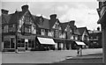
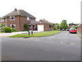
The housing market in RH15 9FG revolves largely around flats, which defines the character of most properties available here. With home ownership standing at 47%, you are entering a market with a significant balance between private homeowners and private renters. This percentage indicates that nearly half the residents have a direct financial stake in the value of their homes, while the other half occupy smaller, often more affordable units. For you as a buyer, this means the area suits those looking for a flat or a smaller property rather than a large semi-detached house. The local stock is dense and urban for an English village, resembling a modern extension to the main street rather than a village green and grass verge setup. Understanding this stock is vital for your expectations regarding space, garden size, and noise levels.
House Prices in RH15 9FG
No properties found in this postcode.
Energy Efficiency in RH15 9FG
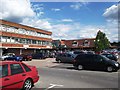
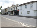
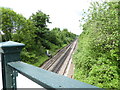
Residents enjoy immediate access to major retailers including Waitrose Burgess, Iceland Church, and The Southern Co-operative Co-op. These local stores are within practical walking distance, meaning you can stock up on groceries without needing a car for routine errands. The presence of a full supermarket and discount chains provides the convenience of a large town concentrated within a few streets. You have the luxury of choosing between premium and budget shopping based on your needs and mood. Rail transport is equally accessible with Burgess Hill Railway Station, Wivelsfield Railway Station, and Hassocks Railway Station all listed as nearby hubs. These stations offer fast links to London Victoria and the wider Southeast. You will find that your daily commute is manageable, whether you are heading to the City or the Reform at Harrow.
Amenities
Schools
| Rank | School | Type | Entry gender | Ages |
|---|
Explore more schools in this area
Go to Schools tabDemographics
The community in this postcode is defined by an adult population with a median age of 47 years. Most residents fall within the 30 to 64-year range, indicating a stable group of house owners and long-term tenants rather than young families or retirees. You will see that 47% of households own their homes outright or through mortgages, which suggests a market where people settle for the long term. The majority of the housing stock consists of flats, meaning you will encounter terrace-style properties or apartment blocks rather than large detached estates. This demographic mix creates a neighbourhood where neighbours are likely your children's godparents or workplace friends. The population is predominantly White, reflecting a traditional British community structure. Living here means engaging with a generation that values consistency and gradual development over rapid change.
Household Size
Accommodation Type
Tenure
Ethnic Group
Religion
Household Composition
Age
Household Deprivation
NS-SEC
Explore more demographic insights in this area
Go to Demographics tabPlanning
Planning Constraints
- Flood RiskPremium
- Ramsar Wetland SitesPremium
- Area of Outstanding Natural BeautyPremium
- Protected Nature ReservePremium
- Protected WoodlandPremium