Area Overview for RH15 9DS
Photos of RH15 9DS
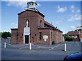
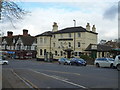
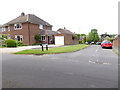
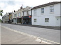
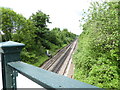
80 photos from this area
Area Information
Key information about the RH15 9DS including its size, population, and administrative classification.
- Area Type
- Postcode
- Area Size
- 5559 m²
- Population
- 1773
- Population Density
- 4826 people/km²
House Prices in RH15 9DS
10
Properties
-
Average Sold Price
-
Lowest Price
-
Highest Price
Showing 10 properties
| Address | Type | Beds | Baths | Last Sale Price | Last Sale Date | |
|---|---|---|---|---|---|---|
| 22 Point Six Technology Ltd, Second Floor Rear, Greenacre Court, Station Road, Burgess Hill, RH15 9DS | office_workshop | - | - | - | - | |
| Nilgosc, Ground Floor, Greenacre Court, Station Road, Burgess Hill, RH15 9DS | office_workshop | - | - | - | - | |
| 22C Station Road, Burgess Hill, RH15 9DS | Flat | - | - | - | - | |
| Nilgosc, Second Floor North, Greenacre Court, Station Road, Burgess Hill, RH15 9DS | retail_financial | - | - | - | - | |
| Extech Ltd, Second Floor South, Greenacre Court, Station Road, Burgess Hill, RH15 9DS | office_workshop | - | - | - | - | |
| 22B Station Road, Burgess Hill, RH15 9DS | Flat | - | - | - | - | |
| 22A Station Road, Burgess Hill, RH15 9DS | Flat | 3 | - | - | - | |
| Signposts Mid Sussex Ltd, Ground Floor, 32 Station Road, Burgess Hill, RH15 9DS | Office | - | - | - | - | |
| Ypsilon Uk Ltd, First Floor, 32 Station Road, Burgess Hill, RH15 9DS | Office | - | - | - | - | |
| Flat Above, 26-28 Station Road, Burgess Hill, RH15 9DS | Flat | 1 | 1 | - | - |
Energy Efficiency in RH15 9DS
Amenities
Schools
| Rank | School | Type | Entry gender | Ages |
|---|
Explore more schools in this area
Go to Schools tabDemographics
Household Size
One person
most common
Accommodation Type
Flats
most common
Tenure
47
majority
Ethnic Group
White
most common
Religion
N/A
most common
Household Composition
N/A
most common
Age
47
median
Adults (30-64 years)
most common
Household Deprivation
N/A
with no deprivation
NS-SEC
38
in Lower managerial occupations
Explore more demographic insights in this area
Go to Demographics tabPlanning
Planning Constraints
- Flood RiskPremium
- Ramsar Wetland SitesPremium
- Area of Outstanding Natural BeautyPremium
- Protected Nature ReservePremium
- Protected WoodlandPremium