Area Overview for RH15 9AU
Photos of RH15 9AU

Area Information
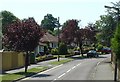
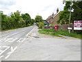
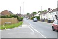
RH15 9AU represents a distinct residential cluster in West Sussex, England, defined by its compact population of 1773 people. This specific postcode serves as a small, tightly knit community rather than a sprawling urban ward. The immediate vicinity focuses on residential living within a manageable footprint, creating a settled atmosphere for those who prioritise locality over anonymity. Residents here operate within a clear geographical boundary where daily commutes and local errands remain straightforward. The area functions as a practical base for households seeking proximity to established local hubs without the density of larger towns. Living in RH15 9AU means participating in a smaller community where neighbours and local services are accessible within a short journey. The demographic profile suggests a mature population with a median age of 47, indicating a neighbourhood that has long been established. Most residents fall into the adult working age bracket between 30 and 64 years old, suggesting a stable community with established families or retired couples. The housing stock consists primarily of flats, catering to a lifestyle that values urban convenience or mixed-use living spaces. This postcode offers a clear identity as a contained residential zone where the character of the local area is shaped by its specific housing tenure and age profile. You can expect a residential environment that balances quiet living with access to the wider Burgess Hill network.
- Area Type
- Postcode
- Area Size
- Not available
- Population
- 1773
- Population Density
- 4826 people/km²
The housing market surrounding RH15 9AU is defined by a significant presence of flats comprising the majority of dwellings. This distinctive accommodation type shapes how buyers approach the local area, with options favouring vertical living or converted structures over detached bungalows. With only 1773 people residing in this specific postcode, the inventory is limited and specialised. Home ownership stands at 47 per cent, indicating that nearly half of the local households secure their own homes while the other half may navigate the rental sector. This split suggests a dynamic market where purchase prices compete with rental yields in a small residential cluster. Prospective buyers targeting this postcode must prioritise flat-hunting strategies, as the accommodation type data overwhelmingly points to this dwelling style. The small population means competition is focused on a narrow segment of the market. Unlike sprawling suburbs where semi-detached houses dominate, you are entering a market defined by compact living units. The 47 per cent ownership rate implies a healthy trade of properties occurring regularly. You can expect to view a specific type of home rather than a wide variety of architectural styles. This concentration of flats caters to individuals or couples who prioritise low-maintenance living in the Rh15 area. The local property landscape is therefore distinct from the rest of West Sussex.
House Prices in RH15 9AU
No properties found in this postcode.
Energy Efficiency in RH15 9AU
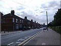
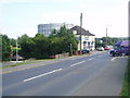
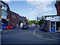
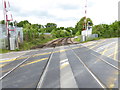
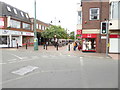
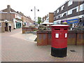
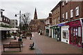
Daily life for residents of RH15 9AU revolves around a practical list of amenities within easy reach. Five retail outlets serve the local needs, including The Southern Co-operative Co-, Waitrose Burgess, and Iceland Church, offering essential grocery options and household goods. These specific stores provide the core shopping experience without the need to travel far. Transport links are equally accessible, with five rail stations located nearby to support commuter journeys. You can walk or take a short ride to Burgess Hill Railway Station, Hassocks Railway Station, or Wivelsfield Railway Station to access the wider railway network. Having these three main stations in the neighbourhood means flexible travel options for work or leisure trips. The presence of Iceland Church and Waitrose Burgess specifically anchors the local high street experience with recognised high-street brands. This mix of retail giants and cooperative stores provides convenience for those living in the flat-heavy accommodation of the area. You gain access to a full range of supermarkets and bakeries immediately adjacent to your home. The cluster of five rail stations facilitates easy commutes to London or Brighton via the local lines. This proximity to transport hubs enhances the value of living in this residential pocket. You enjoy a lifestyle where daily necessities and train tickets are both within minutes.
Amenities
Schools
| Rank | School | Type | Entry gender | Ages |
|---|
Explore more schools in this area
Go to Schools tabDemographics
The community structure in RH15 9AU reflects a mainstream demographic profile dominated by white residents. A median age of 47 years characterises the population, placing the neighbourhood squarely within the adult demographic range of 30 to 64 years old. This age distribution forms the core of the local electorate and household structure, suggesting a mix of families with older children and downsizing individuals. Home ownership sits at 47 per cent, meaning nearly half of the residents hold their property outright or via a mortgage while the remainder likely rent or have other tenure arrangements. This split indicates a balanced market where buyers and renters coexist. The accommodation type data confirms that flats constitute the primary housing form in this cluster. Such dwelling types often appeal to those seeking lower-maintenance living or apartment-style convenience within the local borough. The absence of data on specific deprivation indices means you must focus on the clear housing tenure and age metrics. With a population of 1773 clustering here, the school catchment and local demand are specific to this small group. The demographic makeup is straightforward, lacking significant ethnic diversity according to the available figures. You find a community where stability is common, reflected in the ownership rates and the age of the residents. Living here places you among a preponderance of middle-aged adults in a predominantly white community.
Household Size
Accommodation Type
Tenure
Ethnic Group
Religion
Household Composition
Age
Household Deprivation
NS-SEC
Explore more demographic insights in this area
Go to Demographics tabPlanning
Planning Constraints
- Flood RiskPremium
- Ramsar Wetland SitesPremium
- Area of Outstanding Natural BeautyPremium
- Protected Nature ReservePremium
- Protected WoodlandPremium