Area Overview for RH15 8UR
Photos of RH15 8UR
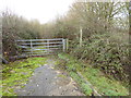
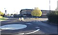
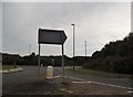
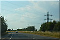

19 photos from this area
Area Information
Key information about the RH15 8UR including its size, population, and administrative classification.
- Area Type
- Postcode
- Area Size
- 1.6 hectares
- Population
- 1608
- Population Density
- 5241 people/km²
House Prices in RH15 8UR
36
Properties
£236,353
Average Sold Price
£93,750
Lowest Price
£453,000
Highest Price
Showing 36 properties
| Address | Type | Beds | Baths | Last Sale Price | Last Sale Date | |
|---|---|---|---|---|---|---|
| 47 Mocatta Way, Burgess Hill, RH15 8UR | Terraced | 2 | 1 | £312,000 | Sep 2025 | |
| 25 Mocatta Way, Burgess Hill, RH15 8UR | Terraced | 2 | 1 | £322,000 | Jul 2025 | |
| 21 Mocatta Way, Burgess Hill, RH15 8UR | Terraced | 2 | 1 | £330,000 | Jun 2025 | |
| 39 Mocatta Way, Burgess Hill, RH15 8UR | Terraced | 2 | - | £315,000 | May 2024 | |
| 19 Mocatta Way, Burgess Hill, RH15 8UR | Terraced | 4 | 2 | £453,000 | Nov 2022 | |
| 45 Mocatta Way, Burgess Hill, RH15 8UR | Terraced | 3 | - | £420,000 | Sep 2022 | |
| 11 Mocatta Way, Burgess Hill, RH15 8UR | Semi-detached | 2 | 1 | £315,000 | Sep 2021 | |
| 27 Mocatta Way, Burgess Hill, RH15 8UR | house | - | - | £285,000 | Oct 2020 | |
| 7 Mocatta Way, Burgess Hill, RH15 8UR | Terraced | 3 | 2 | £335,000 | Aug 2020 | |
| 10 Mocatta Way, Burgess Hill, RH15 8UR | house | 3 | 1 | £335,000 | Oct 2019 |
Page 1 of 4
Energy Efficiency in RH15 8UR
Amenities
Schools
| Rank | School | Type | Entry gender | Ages |
|---|
Explore more schools in this area
Go to Schools tabDemographics
Household Size
Two person
most common
Accommodation Type
Houses
most common
Tenure
80
majority
Ethnic Group
White
most common
Religion
N/A
most common
Household Composition
N/A
most common
Age
47
median
Adults (30-64 years)
most common
Household Deprivation
N/A
with no deprivation
NS-SEC
44
in Lower managerial occupations
Explore more demographic insights in this area
Go to Demographics tabPlanning
Planning Constraints
- Flood RiskPremium
- Ramsar Wetland SitesPremium
- Area of Outstanding Natural BeautyPremium
- Protected Nature ReservePremium
- Protected WoodlandPremium