Area Overview for RH15 0ZN
Photos of RH15 0ZN
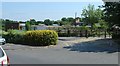
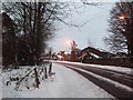
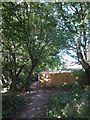
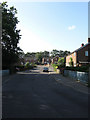
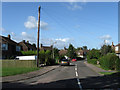
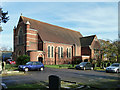
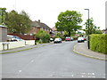
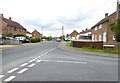
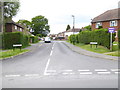
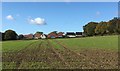
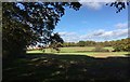
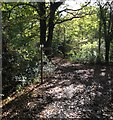
37 photos from this area
Area Information
Key information about the RH15 0ZN including its size, population, and administrative classification.
- Area Type
- Postcode
- Area Size
- 6678 m²
- Population
- 1568
- Population Density
- 5598 people/km²
House Prices in RH15 0ZN
22
Properties
£334,386
Average Sold Price
£219,950
Lowest Price
£535,000
Highest Price
Showing 22 properties
| Address | Type | Beds | Baths | Last Sale Price | Last Sale Date | |
|---|---|---|---|---|---|---|
| 25 Beacon Crescent, Burgess Hill, RH15 0ZN | Detached | 3 | 2 | £535,000 | Mar 2025 | |
| 39 Beacon Crescent, Burgess Hill, RH15 0ZN | house | - | - | £360,000 | Nov 2023 | |
| 63 Beacon Crescent, Burgess Hill, RH15 0ZN | Flat | - | - | £280,000 | Apr 2023 | |
| 41 Beacon Crescent, Burgess Hill, RH15 0ZN | Terraced | 2 | 2 | £367,500 | Oct 2022 | |
| 35 Beacon Crescent, Burgess Hill, RH15 0ZN | Retail | 2 | 1 | £305,000 | Aug 2022 | |
| 61 Beacon Crescent, Burgess Hill, RH15 0ZN | Flat | - | - | £275,000 | Apr 2019 | |
| 59 Beacon Crescent, Burgess Hill, RH15 0ZN | Flat | - | - | £270,000 | Feb 2019 | |
| 65 Beacon Crescent, Burgess Hill, RH15 0ZN | Flat | - | - | £275,000 | Feb 2019 | |
| 43 Beacon Crescent, Burgess Hill, RH15 0ZN | house | - | - | £391,500 | Jan 2019 | |
| 67 Beacon Crescent, Burgess Hill, RH15 0ZN | Flat | - | - | £219,950 | Jan 2019 |
Page 1 of 3
Energy Efficiency in RH15 0ZN
Amenities
Schools
| Rank | School | Type | Entry gender | Ages |
|---|
Explore more schools in this area
Go to Schools tabDemographics
Household Size
Two person
most common
Accommodation Type
Houses
most common
Tenure
79
majority
Ethnic Group
White
most common
Religion
N/A
most common
Household Composition
N/A
most common
Age
47
median
Adults (30-64 years)
most common
Household Deprivation
N/A
with no deprivation
NS-SEC
38
in Lower managerial occupations
Explore more demographic insights in this area
Go to Demographics tabPlanning
Planning Constraints
- Flood RiskPremium
- Ramsar Wetland SitesPremium
- Area of Outstanding Natural BeautyPremium
- Protected Nature ReservePremium
- Protected WoodlandPremium