Area Overview for RH15 0LW
Photos of RH15 0LW
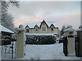
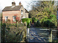
30 photos from this area
Area Information
Key information about the RH15 0LW including its size, population, and administrative classification.
- Area Type
- Postcode
- Area Size
- 1.4 hectares
- Population
- 1632
- Population Density
- 2242 people/km²
House Prices in RH15 0LW
32
Properties
£247,675
Average Sold Price
£88,750
Lowest Price
£425,000
Highest Price
Showing 32 properties
| Address | Type | Beds | Baths | Last Sale Price | Last Sale Date | |
|---|---|---|---|---|---|---|
| 16 The Ridings, Burgess Hill, RH15 0LW | Semi-detached | 3 | 1 | £415,000 | Feb 2025 | |
| 5 The Ridings, Burgess Hill, RH15 0LW | Semi-detached | 3 | 1 | £425,000 | Sep 2020 | |
| 12 The Ridings, Burgess Hill, RH15 0LW | Detached | 3 | - | £382,500 | Aug 2018 | |
| 22 The Ridings, Burgess Hill, RH15 0LW | house | - | - | £322,500 | Sep 2016 | |
| 26 The Ridings, Burgess Hill, RH15 0LW | house | - | - | £319,950 | Jan 2016 | |
| 2 The Ridings, Burgess Hill, RH15 0LW | Detached | 3 | - | £320,000 | Aug 2015 | |
| 3 The Ridings, Burgess Hill, RH15 0LW | Detached | 3 | 1 | £300,000 | Oct 2014 | |
| 18 The Ridings, Burgess Hill, RH15 0LW | Semi-detached | 3 | 1 | £250,000 | Jan 2014 | |
| 11 The Ridings, Burgess Hill, RH15 0LW | Detached | 4 | 2 | £280,000 | Aug 2012 | |
| 30 The Ridings, Burgess Hill, RH15 0LW | house | - | - | £219,000 | Jan 2011 |
Page 1 of 4
Energy Efficiency in RH15 0LW
Amenities
Schools
| Rank | School | Type | Entry gender | Ages |
|---|
Explore more schools in this area
Go to Schools tabDemographics
Household Size
Two person
most common
Accommodation Type
Houses
most common
Tenure
89
majority
Ethnic Group
White
most common
Religion
N/A
most common
Household Composition
N/A
most common
Age
47
median
Adults (30-64 years)
most common
Household Deprivation
N/A
with no deprivation
NS-SEC
47
in Lower managerial occupations
Explore more demographic insights in this area
Go to Demographics tabPlanning
Planning Constraints
- Flood RiskPremium
- Ramsar Wetland SitesPremium
- Area of Outstanding Natural BeautyPremium
- Protected Nature ReservePremium
- Protected WoodlandPremium