Area Overview for RH15 0JL
Photos of RH15 0JL
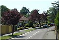
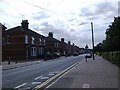
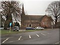
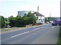
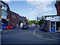
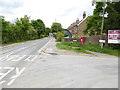
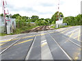
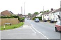
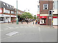

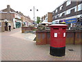
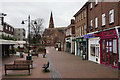
80 photos from this area
Area Information
Key information about the RH15 0JL including its size, population, and administrative classification.
- Area Type
- Postcode
- Area Size
- 1.7 hectares
- Population
- 1721
- Population Density
- 4957 people/km²
House Prices in RH15 0JL
60
Properties
£212,439
Average Sold Price
£51,500
Lowest Price
£450,000
Highest Price
Showing 60 properties
| Address | Type | Beds | Baths | Last Sale Price | Last Sale Date | |
|---|---|---|---|---|---|---|
| 93 Junction Road, Burgess Hill, RH15 0JL | Terraced | 2 | 1 | £339,500 | Sep 2025 | |
| 153 Junction Road, Burgess Hill, RH15 0JL | Terraced | 2 | 1 | £205,000 | Sep 2025 | |
| 65 Junction Road, Burgess Hill, RH15 0JL | Retail | 4 | 2 | £436,000 | Jun 2025 | |
| 83 Junction Road, Burgess Hill, RH15 0JL | Terraced | 2 | 1 | £291,000 | Jun 2025 | |
| 71 Junction Road, Burgess Hill, RH15 0JL | Terraced | 2 | - | £300,000 | Feb 2025 | |
| 115 Junction Road, Burgess Hill, RH15 0JL | Terraced | 2 | 1 | £335,000 | May 2024 | |
| 91 Junction Road, Burgess Hill, RH15 0JL | Terraced | 2 | 1 | £328,000 | Sep 2023 | |
| 59 Junction Road, Burgess Hill, RH15 0JL | house | 3 | 1 | £347,000 | Nov 2022 | |
| 103 Junction Road, Burgess Hill, RH15 0JL | house | - | - | £283,000 | Aug 2022 | |
| 135 Junction Road, Burgess Hill, RH15 0JL | house | - | - | £450,000 | Feb 2022 |
Page 1 of 6
Energy Efficiency in RH15 0JL
Amenities
Schools
| Rank | School | Type | Entry gender | Ages |
|---|
Explore more schools in this area
Go to Schools tabDemographics
Household Size
Two person
most common
Accommodation Type
Houses
most common
Tenure
76
majority
Ethnic Group
White
most common
Religion
N/A
most common
Household Composition
N/A
most common
Age
47
median
Adults (30-64 years)
most common
Household Deprivation
N/A
with no deprivation
NS-SEC
40
in Lower managerial occupations
Explore more demographic insights in this area
Go to Demographics tabPlanning
Planning Constraints
- Flood RiskPremium
- Ramsar Wetland SitesPremium
- Area of Outstanding Natural BeautyPremium
- Protected Nature ReservePremium
- Protected WoodlandPremium