Area Overview for RH14 9RF
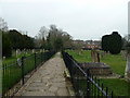
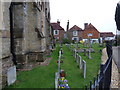
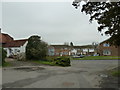
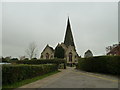
Photos of RH14 9RF
Area Information
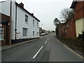
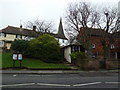
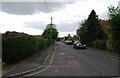
Rh14 9RF represents a specific residential cluster within the broader Horsham postcode district, situated in the south-east of England. This small area covers just 3783 square metres and serves a population of 2106 residents. Living in RH14 9RF means inhabiting a compact neighbourhood where the physical space and community are tightly interwoven. The location functions as a distinct housing pocket rather than a vast district, which often fosters a stronger sense of local identity among those residing there. You are dealing with a defined space of less than four hectares, making the area feel immediate and accessible. Your daily commute or walk to services happens within a very enclosed environment. The postcode defines a precise geographical boundary that encompasses a specific group of households. When you choose this location, you select a area with clear limits and a focused population base. The smaller footprint means that the characteristics of the area permeate every corner of the neighbourhood without dilution from surrounding zones. Homes in RH14 9RF exist within this strictly bounded perimeter, creating a contained living experience where the boundaries of the community are well understood by local residents.
- Area Type
- Postcode
- Area Size
- 3783 m²
- Population
- 2106
- Population Density
- 4249 people/km²
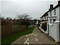
The property market in RH14 9RF is defined by a landscape where homeownership is the dominant reality. With 78% of the population owning their homes, the area functions overwhelmingly as an owner-occupied estate rather than a rental district. This statistic fundamentally shapes the character of the neighbourhood, as the vast majority of residents have purchased their properties and sought to make them their long-term residences. Accommodation in RH14 9RF consists primarily of houses, meaning you will not find high-rise blocks or purpose-built flats as the standard housing solution. This focus on houses creates a market geared toward traditional family living and established neighbourhood values. Buyers looking at this small area should expect a stock dominated by detached or semi-detached properties designed for permanence. The high ownership rate implies that buyers in RH14 9RF face competition from other motivated owners who view their current homes as secure assets. The market reflects a community where transactions are driven by lifecycle events, such as succession or upgrades, rather than speculative investment or student rentals. For those seeking to purchase homes in RH14 9RF, the availability will be tailored to the needs of established families and older professionals.
House Prices in RH14 9RF
Showing 4 properties
| Address | Type | Beds | Baths | Last Sale Price | Last Sale Date | |
|---|---|---|---|---|---|---|
| 3 Station Road, Billingshurst, RH14 9RF | Detached | 4 | 2 | £513,000 | Nov 2020 | |
| Stable Cottage, 5 Station Road, Billingshurst, RH14 9RF | Terraced | - | - | £315,000 | Jul 2007 | |
| 11 Station Road, Billingshurst, RH14 9RF | Detached | 2 | 2 | £180,000 | Nov 2003 | |
| Groom Cottage, 7-9 Station Road, Billingshurst, RH14 9RF | Terraced | - | - | £121,000 | Jun 1998 |
Energy Efficiency in RH14 9RF
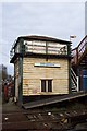
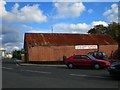
Residents of RH14 9RF benefit from immediate access to essential retail and rail transport within practical reach. Three railway stations lie close by, offering easy links to wider destinations: Billingshurst Railway Station, Christs Hospital Railway Station, and Pulborough Railway Station. This rail access provides a straightforward commute network for your daily travel needs. Locally, you have five retail outlets ready for use, including Tesco Billingshurst, Sainsburys Billingshurst, and Morrisons Daily. These specific supermarkets ensure you can handle daily grocery shopping without a significant drive. Living in RH14 9RF grants you convenience without the need for extensive travel to find basic necessities. The combination of these transport hubs and high-street stores creates a functional lifestyle where work and errands are easily combined. You can step out for a train ticket or grab fresh food from the local Morrisons or Tesco with minimal effort. The amenities listed define the practical reality of life here, prioritizing utility and straightforward access for the 2106 people who call this small cluster home.
Amenities
Schools
Families living in RH14 9RF have access to four primary institutions located in close proximity, all of which form the backbone of local education. Billingshurst Junior School operates as a primary institution serving the early stages of secondary education for its catchment area. Billingshurst Infant School provides foundational learning for the younger children within the village. Billingshurst Primary School offers a standard primary education model for local residents. Finally, Billingshurst Primary Academy serves as the designated academy provision for primary-aged students in the neighbourhood. This concentration of primary schools indicates that RH14 9RF is planned as a community where the younger generation is catered for locally. You do not need to look beyond this immediate circle to find primary education options for your children. The presence of both standard primary schools and an academy variant suggests a mix of traditional and modern educational philosophies available directly to you. Living in RH14 9RF ensures that schooling is an integral part of your daily routine, with multiple specialized facilities supporting children from infancy through to the transition at age eleven.
| Rank | School | Type | Entry gender | Ages |
|---|
Explore more schools in this area
Go to Schools tabDemographics
The community in RH14 9RF is predominantly composed of adults, with the most common age range spanning between 30 and 64 years old. This demographic profile suggests a neighbourhood settled by families and professionals rather than young starters or retirees. The median age stands at 47 years, confirming that the heart of the residential population consists of middle-aged households. You will find that 78% of the residents own their homes, indicating a deep level of stability and long-term commitment to the locality. This high rate of ownership points toward an area where people put down roots and invest in their immediate surroundings. Almost all residents live in houses, as this accommodation type dominates the housing stock. The predominant ethnic group is White, which aligns with the typical composition of many established residential towns in this region of the UK. The population density calculates to approximately 556,705 people per square kilometre based on the available metrics, though this figure derives from the specific 3783 square metre area size. This environment is built for stability and demand for family-oriented housing solutions.
Household Size
Accommodation Type
Tenure
Ethnic Group
Religion
Household Composition
Age
Household Deprivation
NS-SEC
Explore more demographic insights in this area
Go to Demographics tabPlanning
Planning Constraints
- Flood RiskPremium
- Ramsar Wetland SitesPremium
- Area of Outstanding Natural BeautyPremium
- Protected Nature ReservePremium
- Protected WoodlandPremium