Area Overview for RH14 9DN
Photos of RH14 9DN

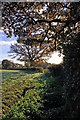
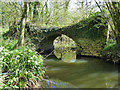
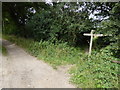
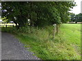
17 photos from this area
Area Information
Key information about the RH14 9DN including its size, population, and administrative classification.
- Area Type
- Postcode
- Area Size
- 1.8 km²
- Population
- 2863
- Population Density
- 68 people/km²
House Prices in RH14 9DN
36
Properties
£1,326,429
Average Sold Price
£790,000
Lowest Price
£2,500,000
Highest Price
Showing 36 properties
| Address | Type | Beds | Baths | Last Sale Price | Last Sale Date | |
|---|---|---|---|---|---|---|
| Coppins, West Chiltington Lane, Coneyhurst, RH14 9DN | house | - | - | £1,950,000 | May 2023 | |
| Palmers Farm, West Chiltington Lane, Coneyhurst, RH14 9DN | Detached | 6 | 3 | £2,500,000 | Mar 2023 | |
| Yew Tree Cottage, West Chiltington Lane, Coneyhurst, RH14 9DN | Detached | 3 | 2 | £800,000 | Jul 2022 | |
| Ridge Barn, West Chiltington Lane, Coneyhurst, RH14 9DN | house | - | - | £1,220,000 | Oct 2018 | |
| Kettlesbridge Cottage, West Chiltington Lane, Coneyhurst, RH14 9DN | house | 4 | - | £1,105,000 | Dec 2017 | |
| Valelands Farm, West Chiltington Lane, Coneyhurst, RH14 9DN | house | - | - | £920,000 | Apr 2017 | |
| Kettlesbridge Farm, West Chiltington Lane, Coneyhurst, RH14 9DN | Land | - | - | £790,000 | Aug 2007 | |
| Palmers Stud, West Chiltington Lane, Billingshurst, RH14 9DN | Detached | 8 | 4 | - | - | |
| Gentians, West Chiltington Lane, Coneyhurst, RH14 9DN | Detached | 5 | 4 | - | - | |
| Unit 6, Barclays Farm Estate, West Chiltington Lane, Coneyhurst, RH14 9DN | Office | - | - | - | - |
Page 1 of 4
Energy Efficiency in RH14 9DN
Amenities
Schools
| Rank | School | Type | Entry gender | Ages |
|---|
Explore more schools in this area
Go to Schools tabDemographics
Household Size
Two person
most common
Accommodation Type
Houses
most common
Tenure
72
majority
Ethnic Group
White
most common
Religion
N/A
most common
Household Composition
N/A
most common
Age
47
median
Adults (30-64 years)
most common
Household Deprivation
N/A
with no deprivation
NS-SEC
42
in Lower managerial occupations
Explore more demographic insights in this area
Go to Demographics tabPlanning
Planning Constraints
- Flood RiskPremium
- Ramsar Wetland SitesPremium
- Area of Outstanding Natural BeautyPremium
- Protected Nature ReservePremium
- Protected WoodlandPremium