Area Overview for RH14 0UG
Photos of RH14 0UG
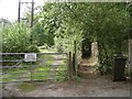
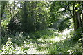
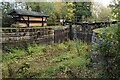
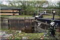
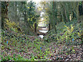
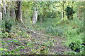

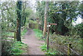
39 photos from this area
Area Information
Key information about the RH14 0UG including its size, population, and administrative classification.
- Area Type
- Postcode
- Area Size
- 8.7 hectares
- Population
- 1653
- Population Density
- 80 people/km²
House Prices in RH14 0UG
14
Properties
£701,283
Average Sold Price
£217,825
Lowest Price
£1,035,000
Highest Price
Showing 14 properties
| Address | Type | Beds | Baths | Last Sale Price | Last Sale Date | |
|---|---|---|---|---|---|---|
| Butlers, Hogwood Road, Ifold, Loxwood, RH14 0UG | house | 5 | 2 | £790,000 | Mar 2024 | |
| Stillmeadow, Hogwood Road, Ifold, Loxwood, RH14 0UG | house | - | - | £880,000 | Sep 2023 | |
| Cedar Croft, Hogwood Road, Ifold, Loxwood, RH14 0UG | Detached | 5 | 3 | £950,000 | Aug 2023 | |
| Nuthatch Cottage, Hogwood Road, Ifold, Loxwood, RH14 0UG | Retail | 4 | 3 | £880,000 | Nov 2022 | |
| Chalbury, Hogwood Road, Ifold, Loxwood, RH14 0UG | Chalet | 5 | - | £590,000 | Oct 2017 | |
| Rose Cottage, Hogwood Road, Ifold, Loxwood, RH14 0UG | Detached | 5 | - | £730,000 | Jul 2014 | |
| Barnwood Paddocks, Hogwood Road, Ifold, Loxwood, RH14 0UG | Bungalow | 5 | - | £1,035,000 | Jul 2012 | |
| Hogwood House, Hogwood Road, Ifold, Loxwood, RH14 0UG | Detached | - | - | £645,000 | Jun 2008 | |
| Beech House, Hogwood Road, Ifold, Loxwood, RH14 0UG | Detached | - | - | £295,000 | Feb 2002 | |
| Indie Anna, Hogwood Road, Ifold, Loxwood, RH14 0UG | Bungalow | - | - | £217,825 | Aug 1999 |
Page 1 of 2
Energy Efficiency in RH14 0UG
Amenities
Schools
| Rank | School | Type | Entry gender | Ages |
|---|
Explore more schools in this area
Go to Schools tabDemographics
Household Size
Two person
most common
Accommodation Type
Houses
most common
Tenure
86
majority
Ethnic Group
White
most common
Religion
N/A
most common
Household Composition
N/A
most common
Age
47
median
Adults (30-64 years)
most common
Household Deprivation
N/A
with no deprivation
NS-SEC
50
in Lower managerial occupations
Explore more demographic insights in this area
Go to Demographics tabPlanning
Planning Constraints
- Flood RiskPremium
- Ramsar Wetland SitesPremium
- Area of Outstanding Natural BeautyPremium
- Protected Nature ReservePremium
- Protected WoodlandPremium