Area Overview for RH14 0TB
Photos of RH14 0TB
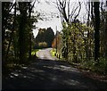
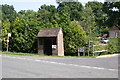
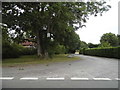
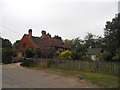
20 photos from this area
Area Information
Key information about the RH14 0TB including its size, population, and administrative classification.
- Area Type
- Postcode
- Area Size
- 1.9 hectares
- Population
- 1974
- Population Density
- 106 people/km²
House Prices in RH14 0TB
12
Properties
£839,994
Average Sold Price
£480,000
Lowest Price
£1,250,000
Highest Price
Showing 12 properties
| Address | Type | Beds | Baths | Last Sale Price | Last Sale Date | |
|---|---|---|---|---|---|---|
| Warm Wishes, The Drive, Ifold, Loxwood, RH14 0TB | Detached | 4 | 3 | £1,250,000 | Nov 2022 | |
| Thane, The Drive, Ifold, Loxwood, RH14 0TB | Retail | 5 | 4 | £1,225,000 | Jun 2022 | |
| White Cottage, The Drive, Ifold, Loxwood, RH14 0TB | Bungalow | 4 | - | £770,000 | Apr 2022 | |
| Wilderness, The Drive, Ifold, Loxwood, RH14 0TB | house | 6 | 4 | £1,150,000 | Apr 2022 | |
| Ferndale, The Drive, Ifold, Loxwood, RH14 0TB | Bungalow | - | - | £540,000 | Jul 2017 | |
| Whispers, The Drive, Ifold, Loxwood, RH14 0TB | Detached | 4 | 1 | £499,950 | Jun 2016 | |
| Karenza, The Drive, Ifold, Loxwood, RH14 0TB | house | - | - | £805,000 | Dec 2015 | |
| Forest Lodge, The Drive, Ifold, Loxwood, RH14 0TB | Bungalow | 3 | - | £480,000 | Jan 2012 | |
| Dumble Dore, The Drive, Ifold, Loxwood, RH14 0TB | Detached | - | - | - | - | |
| Silver Ley, The Drive, Ifold, Loxwood, RH14 0TB | Detached | - | - | - | - |
Page 1 of 2
Energy Efficiency in RH14 0TB
Amenities
Schools
| Rank | School | Type | Entry gender | Ages |
|---|
Explore more schools in this area
Go to Schools tabDemographics
Household Size
Two person
most common
Accommodation Type
Houses
most common
Tenure
83
majority
Ethnic Group
White
most common
Religion
N/A
most common
Household Composition
N/A
most common
Age
47
median
Adults (30-64 years)
most common
Household Deprivation
N/A
with no deprivation
NS-SEC
46
in Lower managerial occupations
Explore more demographic insights in this area
Go to Demographics tabPlanning
Planning Constraints
- Flood RiskPremium
- Ramsar Wetland SitesPremium
- Area of Outstanding Natural BeautyPremium
- Protected Nature ReservePremium
- Protected WoodlandPremium