Area Overview for RH14 0JN
Photos of RH14 0JN
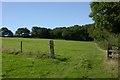
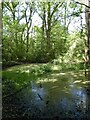
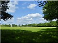
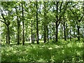
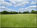
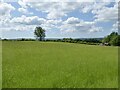
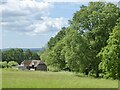
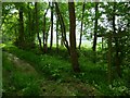
18 photos from this area
Area Information
Key information about the RH14 0JN including its size, population, and administrative classification.
- Area Type
- Postcode
- Area Size
- 1.7 km²
- Population
- 1263
- Population Density
- 45 people/km²
House Prices in RH14 0JN
36
Properties
£1,017,686
Average Sold Price
£202,500
Lowest Price
£3,550,000
Highest Price
Showing 36 properties
| Address | Type | Beds | Baths | Last Sale Price | Last Sale Date | |
|---|---|---|---|---|---|---|
| 4, Hills Green Cottages, Scratching Lane, Kirdford, RH14 0JN | Semi-detached | 4 | 3 | £975,000 | Feb 2025 | |
| 1, Thornhouse Cottages, Scratching Lane, Kirdford, RH14 0JN | house | - | - | £760,000 | Apr 2023 | |
| Little Slifehurst Farm, Scratching Lane, Kirdford, RH14 0JN | house | - | - | £3,550,000 | Nov 2022 | |
| Hills Green, Scratching Lane, Kirdford, RH14 0JN | Detached | - | - | £2,136,175 | Nov 2016 | |
| Kymmings Hill, Scratching Lane, Kirdford, RH14 0JN | Bungalow | 3 | - | £202,500 | Mar 2014 | |
| 3, Hills Green Cottages, Scratching Lane, Kirdford, RH14 0JN | Semi-detached | 4 | 2 | £450,000 | Apr 2010 | |
| 2, Little Slifehurst Cottages, Scratching Lane, Kirdford, RH14 0JN | Semi-detached | - | - | £417,500 | Mar 2007 | |
| 2, Hills Green Cottages, Scratching Lane, Kirdford, RH14 0JN | Semi-detached | - | - | £465,000 | Aug 2006 | |
| 1, Little Slifehurst Cottages, Scratching Lane, Kirdford, RH14 0JN | Semi-detached | - | - | £203,000 | Aug 1999 | |
| Sussex Game Farm House, Scratching Lane, Kirdford, RH14 0JN | Detached | 5 | 3 | - | - |
Page 1 of 4
Energy Efficiency in RH14 0JN
Amenities
Schools
| Rank | School | Type | Entry gender | Ages |
|---|
Explore more schools in this area
Go to Schools tabDemographics
Household Size
Two person
most common
Accommodation Type
Houses
most common
Tenure
69
majority
Ethnic Group
White
most common
Religion
N/A
most common
Household Composition
N/A
most common
Age
47
median
Adults (30-64 years)
most common
Household Deprivation
N/A
with no deprivation
NS-SEC
40
in Lower managerial occupations
Explore more demographic insights in this area
Go to Demographics tabPlanning
Planning Constraints
- Flood RiskPremium
- Ramsar Wetland SitesPremium
- Area of Outstanding Natural BeautyPremium
- Protected Nature ReservePremium
- Protected WoodlandPremium