Area Overview for RH13 9GQ
Photos of RH13 9GQ
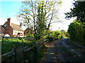
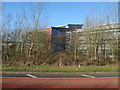
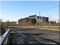
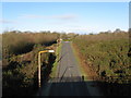

64 photos from this area
Area Information
Key information about the RH13 9GQ including its size, population, and administrative classification.
- Area Type
- Postcode
- Area Size
- 2.9 hectares
- Population
- 1521
- Population Density
- 1357 people/km²
House Prices in RH13 9GQ
13
Properties
£375,946
Average Sold Price
£69,950
Lowest Price
£708,000
Highest Price
Showing 13 properties
| Address | Type | Beds | Baths | Last Sale Price | Last Sale Date | |
|---|---|---|---|---|---|---|
| 62 Blakes Farm Road, Southwater, RH13 9GQ | house | - | - | £708,000 | Dec 2022 | |
| 76 Blakes Farm Road, Southwater, RH13 9GQ | Retail | 2 | 2 | £440,000 | Aug 2022 | |
| 74 Blakes Farm Road, Southwater, RH13 9GQ | Semi-detached | 3 | 2 | £420,000 | Mar 2020 | |
| 58 Blakes Farm Road, Southwater, RH13 9GQ | house | - | - | £660,000 | Jun 2019 | |
| 66 Blakes Farm Road, Southwater, RH13 9GQ | Semi-detached | 5 | 3 | £539,950 | Apr 2016 | |
| 68 Blakes Farm Road, Southwater, RH13 9GQ | house | - | - | £299,950 | May 2015 | |
| 56 Blakes Farm Road, Southwater, RH13 9GQ | Detached | 4 | - | £617,500 | Sep 2014 | |
| 70 Blakes Farm Road, Southwater, RH13 9GQ | Semi-detached | - | - | £204,000 | May 2005 | |
| 78 Blakes Farm Road, Southwater, RH13 9GQ | Semi-detached | - | - | £220,000 | Jan 2005 | |
| 60 Blakes Farm Road, Southwater, RH13 9GQ | house | - | - | £420,000 | Jun 2004 |
Page 1 of 2
Energy Efficiency in RH13 9GQ
Amenities
Schools
| Rank | School | Type | Entry gender | Ages |
|---|
Explore more schools in this area
Go to Schools tabDemographics
Household Size
Family (3-5 people)
most common
Accommodation Type
Houses
most common
Tenure
93
majority
Ethnic Group
White
most common
Religion
N/A
most common
Household Composition
N/A
most common
Age
47
median
Adults (30-64 years)
most common
Household Deprivation
N/A
with no deprivation
NS-SEC
47
in Lower managerial occupations
Explore more demographic insights in this area
Go to Demographics tabPlanning
Planning Constraints
- Flood RiskPremium
- Ramsar Wetland SitesPremium
- Area of Outstanding Natural BeautyPremium
- Protected Nature ReservePremium
- Protected WoodlandPremium