Area Overview for RH13 9AY
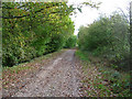
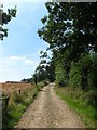
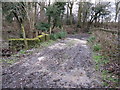
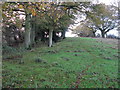
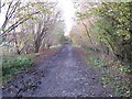
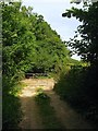
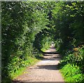
Photos of RH13 9AY


Area Information
RH13 9AY occupies a specific residential cluster covering 31.6 hectares within England. This postcode area supports a population of 1,588 people, creating a compact community with a density of 58 people per square kilometre. Living in RH13 9AY means residing in a relatively small footprint where neighbours are likely to be within close proximity. The area functions as a defined neighbourhood rather than a sprawling district, which often fosters a quieter way of life. Residents here enjoy a settled atmosphere suitable for those seeking a contained environment. The location offers a balance between seclusion and access to wider transport networks. You will find this postcode serves as a stable base for families and individuals who value privacy without total isolation. The small size of the area ensures that infrastructure is tailored to a specific population count rather than fluctuating demands. This density allows for efficient use of local roads and services. The residential nature of RH13 9AY distinguishes it from mixed-use commercial zones. Your daily commutes will start from a clearly defined border. The area represents a traditional choice for those prioritising a specific postcode for purchase or move.
- Area Type
- Postcode
- Area Size
- 31.6 hectares
- Population
- 1588
- Population Density
- 58 people/km²
The property market in RH13 9AY is heavily skewed towards ownership rather than renting. With 80% of residents owning their homes, the area functions primarily as an owner-occupied zone. This statistic highlights that the local stock consists of long-term residences rather than rental properties for short-term lets. The predominant accommodation type is houses, meaning you will not find apartments or flats as the primary housing option. Buying homes in RH13 9AY typically means purchasing a detached, semi-detached, or terrace property designed for families or older homeowners. This market structure suggests prices reflect household wealth and investment rather than speculative rental yields. The stability of owner-occupation often leads to slower price fluctuations compared to volatile rental markets. Maintenance responsibilities fall squarely on the individual homeowner, as consistent in areas with such high ownership rates. If you are looking at this area, expect a selection of residential housing that has seen repeated generations of occupants. The 80% ownership figure implies a shortage of available rental stock for prospective tenants. Consequently, the area appeals to buyers seeking to secure a permanent home rather than landlords seeking yield. The market here rewards those with the means to purchase a house directly.
House Prices in RH13 9AY
No properties found in this postcode.
Energy Efficiency in RH13 9AY
Your lifestyle in RH13 9AY benefits from a range of amenities within practical reach. For shopping needs, you have access to five major retail outlets nearby. Notable supermarkets include Asda Horsham, Budgens Southwater, and Co-op Southwater. These venues provide essential groceries and household goods without requiring a long drive. Transport links are equally convenient with four nearby railway stations serving the route. Key hubs include Christs Hospital Railway Station, Horsham Railway Station, and Billingshurst Railway Station. These stations offer direct connections to broader transport networks for commuters. The proximity of these stations means your daily commute to London or the South Coast is streamlined. Dining options and leisure facilities are accessible through the wider Horsham and Southwater estates that surround the postcode. You can easily reach a variety of restaurants and leisure centres by a short car journey or train commute. The availability of supermarkets ensures you do not need to sacrifice quality for convenience. The transport infrastructure allows you to maintain a rural feel while keeping city opportunities close. Integration of these services supports a balanced life where work, shopping, and travel coexist smoothly.
Amenities
Schools
Families considering RH13 9AY have access to specific educational options within their local vicinity. St Peter's CofE (Aided) Primary School operates nearby as a primary institution. This school holds a held Ofsted rating of 'good', indicating a strong standard of education for younger children. Another relevant institution is Shermanbury Grange, which is listed as an 'other' type school. This designation often points to special needs provision or alternative educational settings supporting specific requirements. The mix of a supported primary school and another type of institution suggests the area caters to diverse educational needs. Families with school-age children will find a designated primary option that meets regulatory standards of quality. The presence of Shermanbury Grange indicates support services exist for children requiring non-standard educational pathways. You must check current admission numbers for these specific schools as they are not part of the local primary cluster. The 'good' rating at St Peter's provides a concrete indicator of academic performance and safeguarding. For residents without primary school children, the availability of secondary options nearby is not detailed in the provided data. Relying on St Peter's means your children benefit from a faith-based curriculum typical of CofE schools.
| Rank | School | Type | Entry gender | Ages |
|---|
Explore more schools in this area
Go to Schools tabDemographics
The community in RH13 9AY shows distinct demographic characteristics that define the local lifestyle. The median age stands at 47 years, indicating a mature population. Most commonly, the residents fall into the adult age range of 30 to 64 years. This profile suggests the area attracts families in their middle years or retirees seeking stability. Home ownership is a defining feature, with 80% of residents owning their properties outright or with a mortgage. This high rate contrasts sharply with areas dominated by private renting. The predominant accommodation type consists of houses, which aligns with the ownership figures. You will rarely find high-rise flats or purpose-built student accommodation here. The predominant ethnic group in the postcode is White, reflecting the area's established character. While specific deprivation data is absent from the provided information, the high home ownership rate often correlates with long-term settlement. This demographic stability means you are joining a community of established residents. The age profile supports local businesses that cater to grown-ups rather than teenagers or young professionals. Families raising children will find peers in the 30 to 40 age bracket. The lack of a youthful under-30 cohort shapes the social dynamic and local amenities used.
Household Size
Accommodation Type
Tenure
Ethnic Group
Religion
Household Composition
Age
Household Deprivation
NS-SEC
Explore more demographic insights in this area
Go to Demographics tabPlanning
Planning Constraints
- Flood RiskPremium
- Ramsar Wetland SitesPremium
- Area of Outstanding Natural BeautyPremium
- Protected Nature ReservePremium
- Protected WoodlandPremium