Area Overview for RH13 8GD
Photos of RH13 8GD
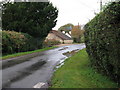
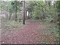
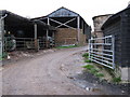
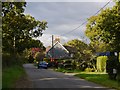
15 photos from this area
Area Information
Key information about the RH13 8GD including its size, population, and administrative classification.
- Area Type
- Postcode
- Area Size
- 23.3 hectares
- Population
- 2863
- Population Density
- 68 people/km²
House Prices in RH13 8GD
27
Properties
£520,677
Average Sold Price
£188,000
Lowest Price
£1,125,000
Highest Price
Showing 27 properties
| Address | Type | Beds | Baths | Last Sale Price | Last Sale Date | |
|---|---|---|---|---|---|---|
| Winter Cottage, Dragons Lane, Dragons Green, RH13 8GD | Semi-detached | 3 | 1 | £655,000 | Jan 2025 | |
| 1 Dragons Lane, Dragons Green, RH13 8GD | Semi-detached | 4 | 3 | £760,000 | Oct 2024 | |
| Gables, Dragons Lane, Dragons Green, RH13 8GD | house | - | - | £1,125,000 | Mar 2024 | |
| Woodside Cottage, Dragons Lane, Dragons Green, RH13 8GD | Semi-detached | 3 | 1 | £565,000 | Mar 2019 | |
| Beech Cottage, Dragons Lane, Dragons Green, RH13 8GD | Detached | 4 | 2 | £594,950 | Dec 2018 | |
| Hawthorns, Dragons Lane, Dragons Green, RH13 8GD | Semi-detached | 4 | 1 | £585,000 | Jan 2018 | |
| 2 Dragons Lane, Dragons Green, RH13 8GD | Semi-detached | - | - | £245,000 | Jan 2011 | |
| Elm House, Dragons Lane, Dragons Green, RH13 8GD | Detached | - | - | £400,000 | Oct 2004 | |
| Well Cottage, Dragons Lane, Dragons Green, RH13 8GD | Detached | - | - | £311,500 | Jul 2001 | |
| Cedar Cottage, Dragons Lane, Dragons Green, RH13 8GD | Semi-detached | - | - | £298,000 | Sep 2000 |
Page 1 of 3
Energy Efficiency in RH13 8GD
Amenities
Schools
| Rank | School | Type | Entry gender | Ages |
|---|
Explore more schools in this area
Go to Schools tabDemographics
Household Size
Two person
most common
Accommodation Type
Houses
most common
Tenure
72
majority
Ethnic Group
White
most common
Religion
N/A
most common
Household Composition
N/A
most common
Age
47
median
Adults (30-64 years)
most common
Household Deprivation
N/A
with no deprivation
NS-SEC
42
in Lower managerial occupations
Explore more demographic insights in this area
Go to Demographics tabPlanning
Planning Constraints
- Flood RiskPremium
- Ramsar Wetland SitesPremium
- Area of Outstanding Natural BeautyPremium
- Protected Nature ReservePremium
- Protected WoodlandPremium