Area Overview for RH13 8FH
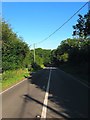
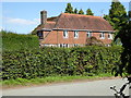
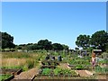
Photos of RH13 8FH


Area Information
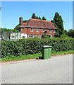
Living in RH13 8FH means residing within a specific postcode area that covers a small residential cluster in England. The population totals 1,228 residents, creating a compact community where neighbours often know one another. With a population density of 94 people per square kilometre, the area avoids the congestion of larger towns while maintaining essential access to services. This settlement functions as a quiet stopover rather than a major hub, yet it connects effectively to wider networks. You will find a neighbourhood defined by its residential focus and low-scale environment. The setting offers a peaceful routine without the crowds of urban centres. Daily life revolves around accessibility to key facilities rather than immediate proximity to shopping high streets or transport terminals. The area sits far enough from major indicators of planning constraints to remain a straightforward choice for settlement. You move here seeking stability and a defined sense of place rather than a sprawling urban experience. The character is one of simplicity, where the scale of the community directly influences the pace of daily activity. Homes in RH13 8FH cater to those who value a contained living environment. The limited number of households contributes to a quieter atmosphere compared to more densely populated districts. You can expect a setting where the local environment remains largely undisturbed by large-scale development. The area serves as a functional residence for families and individuals who prioritise a calm lifestyle over high-energy social opportunities.
- Area Type
- Postcode
- Area Size
- Not available
- Population
- 1228
- Population Density
- 94 people/km²
The property market in RH13 8FH is dominated by owner-occupiers rather than landlords or investment buyers. With 86% of homes owned outright or with a mortgage, the local housing stock reflects long-term residents who intend to stay. This high ownership rate creates a stable market characterised by people who understand the value of their homes and the cost of improvements. You will find a neighbourhood where family needs often dictate property choices. The dominant accommodation type is houses, which aligns with the needs of the 30 to 64-year-old demographic. Fewer than 14% of properties are rental units, suggesting a limited supply of buy-to-let investments or social housing within the immediate cluster. This scarcity of rental stock often pushes prospective buyers into interventions or local purchases rather than quick tenancy arrangements. The market feels more like a community exchange than a speculative playing field. Homes in RH13 8FH are primarily standalone properties rather than flats. This layout supports the median age of 47 and the preference for larger living spaces found in houses. The small total population of 1,228 means the housing stock is finite and specific to the cluster's physical capacity. You cannot find multiple apartment blocks or high-density developments in this postcode. Buying in this area often rewards those who seek security and permanence. The high ownership rate indicates that sellers are serious about their homes and likely to price realistically rather than inflate values for quick sales. When you look at homes in RH13 8FH, you are viewing properties held by people who live and work in the community. This creates a market where reliability trumps rapid turnover.
House Prices in RH13 8FH
No properties found in this postcode.
Energy Efficiency in RH13 8FH
Your daily life in RH13 8FH revolves around practical access to nearby amenities rather than immediate proximity to them. For shopping needs, five retail outlets lie within practical reach. You can visit Co-op Partridge and Co-op Cowfold for local groceries and essentials. For larger shopping trips, you have access to Asda Horsham, which offers a broader range of goods and supermarkets. These venues provide sufficient variety for routine household requirements without requiring a dedicated daily commute into a town centre. Transport links supplement local shopping options with one rail facility at Christs Hospital Railway Station. While not a train‑station doorstep location, this station connects you to wider transport networks. You can combine local walks with occasional rail travel to reach further destinations. If you prefer independent shopping, the small retail count supports a slower pace where you often buy from the immediate local options. The residential cluster encourages walking to these centres as they lie within practical reach. You do not need to own a car for every errand, though having one remains sensible for reaching Asda Horsham efficiently. The mix of Co‑op supermarkets provides consistency in food quality and availability. Dining options are not explicitly listed, so you rely on the retail offerings for takeaway or in-store food. Parks and leisure facilities are not detailed in the immediate amenity list, so recreational activities likely centre on personal initiative or nearby nature reserves outside the postcode. Your lifestyle mirrors the scale of the community: functional, accessible, and focused on essential services. Living in RH13 8FH means choosing convenience over entertainment density. The amenities available support a quiet, domestic routine without unnecessary travel.
Amenities
Schools
| Rank | School | Type | Entry gender | Ages |
|---|
Explore more schools in this area
Go to Schools tabDemographics
The community in RH13 8FH reflects a mature demographic profile with a median age of 47 years. Adults between 30 and 64 years represent the most common age range within the population. This age distribution suggests a stable group of families and established professionals rather than a transient student population. You are dealing with a neighbourhood where residents have likely settled for the long term. Home ownership niveles at 86%, indicating a very high rate of owner-occupied housing. Only 14% of residents rent their homes, which points to a community invested in local maintenance and stability. The accommodation type consists principally of houses, with no mention of flats or high-rise living. This structural composition aligns with the needs of families and older adults seeking privacy and space. The predominant ethnic group is White, reflecting the traditional makeup of many suburban settlements in England. This demographic homogeneity often correlates with lower turnover rates and established community networks. You will find a population that likes its local amenities and maintains routine interactions with neighbours. This profile typically supports local schools and community facilities that cater to a specific age and cultural expectation. Deprivation indices are not explicitly broken out in the available data, but the high home ownership rate suggests financial stability among residents. The area does not appear to attract temporary or low-income tenancy, reinforcing the picture of a settled, middle-aged population. Living in RH13 8FH means joining a group of people who have made significant local roots. The community feel is consistent with areas where residents vote with their feet and stay for generations.
Household Size
Accommodation Type
Tenure
Ethnic Group
Religion
Household Composition
Age
Household Deprivation
NS-SEC
Explore more demographic insights in this area
Go to Demographics tabPlanning
Planning Constraints
- Flood RiskPremium
- Ramsar Wetland SitesPremium
- Area of Outstanding Natural BeautyPremium
- Protected Nature ReservePremium
- Protected WoodlandPremium