Area Overview for RH13 6RE
Photos of RH13 6RE
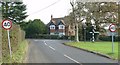
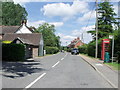
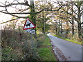
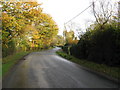
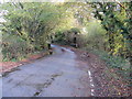
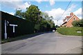
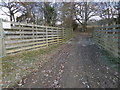
46 photos from this area
Area Information
Key information about the RH13 6RE including its size, population, and administrative classification.
- Area Type
- Postcode
- Area Size
- 14.3 hectares
- Population
- 1349
- Population Density
- 86 people/km²
House Prices in RH13 6RE
18
Properties
£603,250
Average Sold Price
£320,000
Lowest Price
£1,100,000
Highest Price
Showing 18 properties
| Address | Type | Beds | Baths | Last Sale Price | Last Sale Date | |
|---|---|---|---|---|---|---|
| 6, Hampton Cottages, Nuthurst Road, Maplehurst, RH13 6RE | Terraced | 3 | 1 | £387,500 | Jul 2025 | |
| Fernfield Cottage, Nuthurst Road, Maplehurst, RH13 6RE | Detached | 4 | 2 | £1,005,000 | Jun 2024 | |
| Pipers Croft Cottage, Nuthurst Road, Maplehurst, RH13 6RE | Detached | 2 | 1 | £605,000 | Sep 2023 | |
| 4, Hampton Cottages, Nuthurst Road, Maplehurst, RH13 6RE | Terraced | 2 | 1 | £365,000 | Apr 2023 | |
| 7, Hampton Cottages, Nuthurst Road, Maplehurst, RH13 6RE | Terraced | 3 | 2 | £365,000 | Sep 2021 | |
| Ferncroft, Nuthurst Road, Maplehurst, RH13 6RE | house | - | - | £1,100,000 | May 2017 | |
| 8, Hampton Cottages, Nuthurst Road, Maplehurst, RH13 6RE | Terraced | 3 | 1 | £320,000 | Apr 2014 | |
| Maple Villa, Nuthurst Road, Maplehurst, RH13 6RE | house | - | - | £700,000 | Oct 2013 | |
| The Old Cottage Farm, Nuthurst Road, Maplehurst, RH13 6RE | house | - | - | £800,000 | Jul 2003 | |
| Dalby, Nuthurst Road, Maplehurst, RH13 6RE | Detached | 4 | 3 | £385,000 | Jul 2002 |
Page 1 of 2
Energy Efficiency in RH13 6RE
Amenities
Schools
| Rank | School | Type | Entry gender | Ages |
|---|
Explore more schools in this area
Go to Schools tabDemographics
Household Size
Two person
most common
Accommodation Type
Houses
most common
Tenure
89
majority
Ethnic Group
White
most common
Religion
N/A
most common
Household Composition
N/A
most common
Age
47
median
Adults (30-64 years)
most common
Household Deprivation
N/A
with no deprivation
NS-SEC
50
in Lower managerial occupations
Explore more demographic insights in this area
Go to Demographics tabPlanning
Planning Constraints
- Flood RiskPremium
- Ramsar Wetland SitesPremium
- Area of Outstanding Natural BeautyPremium
- Protected Nature ReservePremium
- Protected WoodlandPremium