Area Overview for RH13 6BF
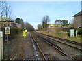
Photos of RH13 6BF
Area Information
Living in RH13 6BF means residing within a tightly defined residential cluster covering just 1.6 hectares. This small postcode area forms part of the broader Horsham district, offering a concentrated living environment for 1,903 residents. You will find this location sits at a high population density of 117,491 people per square kilometre, reflecting its compact urban nature rather than sprawling sprawl. The area attracts adults primarily aged between 30 and 64 years, creating a community focused on the practicalities of family life and established careers. Daily life revolves around close proximity to essential services rather than extensive green corridors, though the abundance of nearby transport links mitigates this compactness. The demographic profile suggests a stable neighbourhood where long-term residents manage their housing needs efficiently. With 60% of households owning their homes, the local atmosphere feels settled and permanent. Residents benefit from immediate access to major railway stations, ensuring commutes to London and other regional hubs are straightforward. The absence of significant planning constraints, such as protected wetlands or areas of outstanding natural beauty, means development and infrastructure follow standard regulatory paths without special restrictions.
- Area Type
- Postcode
- Area Size
- 1.6 hectares
- Population
- 1903
- Population Density
- 3455 people/km²
The property market in RH13 6BF is defined by a striking imbalance between ownership and rental sectors, driven largely by the physical nature of the housing stock. You will find that 60% of the local community owns their home, placing RH13 6BF firmly within the owner-occupied bracket for this specific postcode. However, the predominant accommodation type is the flat. This combination explains the density; flats allow more households to occupy a smaller land footprint, which is necessary given the 1.6 hectares of land available. For buyers looking at homes in RH13 6BF, the primary product is apartment living rather than semi-detached or terraced houses found in wider suburban areas. This structure suits those seeking to step into the ladder or downsize while maintaining access to amenities. The high concentration of flats also suggests a market that could round out the rental sector, even though 60% of people buy. The immediate surroundings likely mirror this stock, offering a cohesive look to the streetscape. While the area is small, the lack of planning constraints on dangerous terrain or protected woodlands ensures that the physical environment remains consistent with typical urban development standards for Horsham.
House Prices in RH13 6BF
Showing 37 properties
| Address | Type | Beds | Baths | Last Sale Price | Last Sale Date | |
|---|---|---|---|---|---|---|
| 46 Oak Tree Way, Horsham, RH13 6BF | Terraced | 2 | 1 | £345,000 | Mar 2025 | |
| 74 Oak Tree Way, Horsham, RH13 6BF | Detached | 3 | 2 | £500,000 | Jan 2025 | |
| 55 Oak Tree Way, Horsham, RH13 6BF | Detached | 4 | 2 | £575,000 | Jun 2024 | |
| 71 Oak Tree Way, Horsham, RH13 6BF | Semi-detached | 3 | 2 | £462,500 | May 2024 | |
| 58 Oak Tree Way, Horsham, RH13 6BF | Detached | 4 | 2 | £545,000 | Jan 2023 | |
| 63 Oak Tree Way, Horsham, RH13 6BF | Retail | 3 | 2 | £525,000 | Sep 2022 | |
| 61 Oak Tree Way, Horsham, RH13 6BF | Detached | 3 | - | £480,000 | Aug 2022 | |
| 56 Oak Tree Way, Horsham, RH13 6BF | Detached | - | - | £1,500 | Jun 2021 | |
| 53 Oak Tree Way, Horsham, RH13 6BF | house | - | - | £485,000 | Mar 2021 | |
| 73 Oak Tree Way, Horsham, RH13 6BF | house | 3 | - | £355,000 | Nov 2020 |
Energy Efficiency in RH13 6BF
The lifestyle in RH13 6BF is supported by a network of retail and transport hubs located just outside the residential cluster. You have ready access to major chains including Tesco Horsham, Co-op Roffey, and Lidl Horsham. These five retail outlets cover daily shopping needs, from fresh groceries to household essentials, ensuring you rarely need to travel far for basics. The presence of Co-op Roffey specifically suggests a distribution point for parcels and online orders, supporting the high volume of residents served by this small area. Transport adds another layer to your daily life, with five railway stations nearby serving a range of destinations. Workshops or therapy rooms at Horsham or Roffey may also add a local touch to the commercial offering. The area lacks large leisure parks or dedicated sports centres within the postcode itself, directing residents toward the slightly wider catchment of Horsham for more extensive recreation. The proximity of Tesco and Lidl means errands are quick rather than requiring significant time investment. You can walk or take a short drive to reach these amenities, maintaining a balance between the quiet of a dense residential zone and the convenience of being close to a high street environment.
Amenities
Schools
Families living in RH13 6BF have a clear selection of educational options within practical reach. Kingslea Primary School stands out as a key local institution, holding a "good" Ofsted rating, which signals a reliable standard of education for primary-age children. Further along the route lies Chesworth Junior School, serving children as they transition to the secondary phase of their education. For very young families or those considering early education, Horsham Nursery School provides care for toddlers and infants. This mixture of provision means that children in the area can progress from nursery through their junior years without leaving the immediate vicinity. The presence of a primary school with a "good" rating specifically at Kingslea suggests a commitment to educational standards that parents can trust. While the data does not list secondary schools, the proximity of Junior schools implies a larger network further afield. The schools listed cater to the dominant age group of 30 to 64, ensuring that education is central to the local ecosystem. You can expect a focused environment where the curriculum is managed to support steady academic progress without the complex variety of larger district schools.
| Rank | School | Type | Entry gender | Ages |
|---|
Explore more schools in this area
Go to Schools tabDemographics
The community in RH13 6BF is characterised by a predominantly post-childhood age profile. Half of all residents are aged 47 years or older, with the largest group falling into the 30 to 64 year range. This distribution indicates a neighbourhood stabilised by families with children and professionals who have moved beyond their twenties. Housing tenure reflects this stability, as 60% of occupants hold ownership of their property. The remaining 40% likely reside in rental accommodations or shared living arrangements suitable for their life stage. Accommodation overwhelmingly consists of flats, a detail that aligns with the high density figures you have already encountered. This concentration of flats suggests an urban settlement pattern rather than detached housing estates. Ethnically, the White ethnic group forms the predominant demographic within the area. Deprivation metrics, while not explicitly broken down in local statistics, correlate with the high home ownership rate and the mature age profile, hinting at an area with financial security among its residents. The 30-64 age bracket being the most common implies strong demand for amenities suitable for working adults and active families rather than retired communities or student enclaves.
Household Size
Accommodation Type
Tenure
Ethnic Group
Religion
Household Composition
Age
Household Deprivation
NS-SEC
Explore more demographic insights in this area
Go to Demographics tabPlanning
Planning Constraints
- Flood RiskPremium
- Ramsar Wetland SitesPremium
- Area of Outstanding Natural BeautyPremium
- Protected Nature ReservePremium
- Protected WoodlandPremium