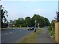
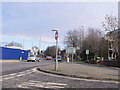
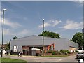
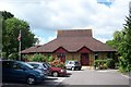
Area Overview for RH13 5EU
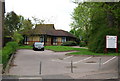
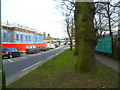
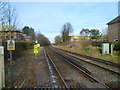
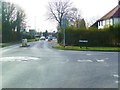
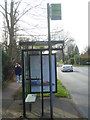
Photos of RH13 5EU
Area Information
Living in RH13 5EU means residing in a compact residential cluster covering just 1.1 hectares. This small footprint houses 1,620 people, creating a very dense neighbourhood where proximity is the defining characteristic of daily life. You will find that homes here are situated in close quarters, typical of a specific postcode area that prioritises tight-knit community interaction over sprawling estates. The population density reaches an intense 150,288 people per square kilometre, which suggests a bustling environment where resources and neighbours are immediately at hand. This location sits within the broader Horsham region, offering easy access to established transport hubs and local services despite its small scale. Because the area is so concentrated, you may find the atmosphere feels energetic and central, rather than isolated. Residents benefit from immediate access to retail parks and railway stations located just a short walk or drive away. The layout focuses purely on housing, devoid of large industrial zones or protected green spaces within the immediate boundary. For those seeking a home in this specific cluster, it represents a straightforward residential option with high accessibility but limited open space. The character is defined by efficiency and density, making it suitable for buyers who value convenience over expansive gardens or quiet detachment.
- Area Type
- Postcode
- Area Size
- 1.1 hectares
- Population
- 1620
- Population Density
- 3623 people/km²
Homes in RH13 5EU are overwhelmingly owner-occupied, with 83% of households belonging to their residences. This statistic points to a stable, long-term market rather than a volatile rental sector. The accommodation type is exclusively houses, meaning you will not find apartments or flats within this specific postcode boundary. Buyers looking for property here are entering a market defined by traditional house structures rather than modern high-density living. This dominance of ownership suggests that price volatility may be lower compared to areas with high rental turnover. Tenants often chase job changes quickly, whereas owners tend to hold onto properties for longer periods, potentially leading to slower turnover rates. For those considering this small 1.1-hectare cluster, the implication is that competition is likely focused on specific house types rather than competing for scarce apartments. The lack of rental data for this exact section reinforces the idea that this is a residential zone designed for families or individuals seeking to put down roots. If you are looking to buy, expect a market where sellers are often motivated to stay within the community or trade for a larger property elsewhere in the Horsham district. The concentration of houses implies standard local housing stock, familiar to anyone moving into the wider RH13 postcode area.
House Prices in RH13 5EU
Showing 37 properties
| Address | Type | Beds | Baths | Last Sale Price | Last Sale Date | |
|---|---|---|---|---|---|---|
| 82 Station Road, Horsham, RH13 5EU | house | - | - | £605,000 | Oct 2023 | |
| 78 Station Road, Horsham, RH13 5EU | Semi-detached | 3 | 1 | £575,000 | Sep 2023 | |
| 80 Station Road, Horsham, RH13 5EU | house | - | - | £365,000 | Aug 2022 | |
| 66A Station Road, Horsham, RH13 5EU | Flat | - | - | £250,000 | May 2021 | |
| 88 Station Road, Horsham, RH13 5EU | Terraced | 4 | 2 | £425,000 | Mar 2020 | |
| 50 Station Road, Horsham, RH13 5EU | Maisonette | 2 | 1 | £250,000 | May 2018 | |
| 70A Station Road, Horsham, RH13 5EU | Flat | - | - | £166,000 | Apr 2014 | |
| 64 Station Road, Horsham, RH13 5EU | Semi-detached | 4 | - | £336,000 | Feb 2014 | |
| 84 Station Road, Horsham, RH13 5EU | Terraced | 3 | - | £293,000 | Jul 2012 | |
| 60 Station Road, Horsham, RH13 5EU | house | 3 | - | £306,000 | Jun 2011 |
Energy Efficiency in RH13 5EU
Life in RH13 5EU revolves around convenience, with five retail units located a short distance away. Lidl Horsham, Tesco Horsham, and Morrisons Daily are among the accessible venues for weekly shopping. These major supermarkets handle grocery needs without requiring long journeys into distant towns. The presence of three of the UK's largest supermarket chains indicates a focus on affordability and variety for the 1,620 residents of this cluster. Transport opciones include five accessible railway hubs. Horsham Railway Station stands as the primary link for regional travel, while Littlehaven and Warnham stations offer additional connectivity points. This density of rail access ensures you are never far from a main line station. Daily life involves shopping at nearby supermarkets and catching trains for commutes, both of which are well within reasonable reach. While parks and diverse leisure clubs are not listed in the specific amenity data for this exact postcode, the proximity to Horsham implies access to the wider town's green spaces and cultural facilities. The lifestyle here is sparse yet functional, relying heavily on nearby retail and transport rather than on-site entertainment. You will find that your social and leisure needs can be met through short trips to the larger Horsham area, keeping daily life simple and uncluttered.
Amenities
Schools
Families considering RH13 5EU will find Millais School as the nearest educational provision for young children. This primary school holds a 'good' Ofsted rating, indicating standards set above the baseline of acceptable education. The presence of a well-rated primary option suggests that the area attracts families with school-age children who require local enrolment. Currently, there are no secondary schools listed in the immediate vicinity of this postcode cluster. This means that pupils progressing from Millais School would typically need to travel to neighbour districts for secondary education. For parents, this implies a routine involving either shared transport arrangements or independent travel to reach high schools outside the immediate 1.1-hectare boundary. The mix of one good primary and zero secondary options in direct data highlights a reliance on the wider Horsham catchment area for older students. Living in RH13 5EU requires families to integrate Millais School into their daily routines for early schooling. If your children are already enrolled at Millais, continuing education becomes the primary internal focus, while secondary education requires a broader geographical perspective. The small size of the residential cluster means that school travel often blends with commuting to nearby railway stations.
| Rank | School | Type | Entry gender | Ages |
|---|
Explore more schools in this area
Go to Schools tabDemographics
The community within RH13 5EU reflects a mature, established population. The median age here is 47 years, firmly placing the demographic centre in the adult bracket of 30 to 64 years. This age profile indicates an area anchored by working professionals and established families rather than students or retirees. Home ownership stands at a significant 83%, suggesting that property in this postcode stabilises into long-term family holdings rather than a transient rental market. Almost all accommodation consists of houses, distinguishing this cluster from urban flats or modern apartment complexes. The predominant ethnic group is White, which aligns with the demographic trends of the surrounding South East region. There are no significant gaps or minority pockets mentioned in the available records for this specific postcode, pointing to a fairly homogenous social fabric. Deprivation data is not provided for this exact 1.1-hectare cluster, so the quality of life metrics rely on broader regional averages rather than specific local indices. However, the high rate of ownership implies financial stability among residents. Households likely consist of parents, couples, and perhaps some empty nesters who have moved from larger homes elsewhere. The composition is consistent with areas near established railway lines where families seek a balance between accessibility and suburban living in a compact footprint.
Household Size
Accommodation Type
Tenure
Ethnic Group
Religion
Household Composition
Age
Household Deprivation
NS-SEC
Explore more demographic insights in this area
Go to Demographics tabPlanning
Planning Constraints
- Flood RiskPremium
- Ramsar Wetland SitesPremium
- Area of Outstanding Natural BeautyPremium
- Protected Nature ReservePremium
- Protected WoodlandPremium