Area Overview for RH12 4PT
Photos of RH12 4PT
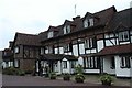
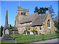
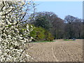
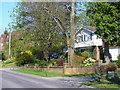
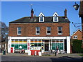
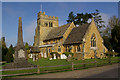
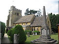
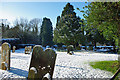
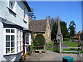
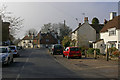
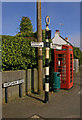
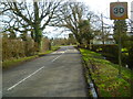
98 photos from this area
Area Information
Key information about the RH12 4PT including its size, population, and administrative classification.
- Area Type
- Postcode
- Area Size
- 7.8 hectares
- Population
- 1396
- Population Density
- 95 people/km²
House Prices in RH12 4PT
24
Properties
£574,409
Average Sold Price
£111,000
Lowest Price
£1,050,000
Highest Price
Showing 24 properties
| Address | Type | Beds | Baths | Last Sale Price | Last Sale Date | |
|---|---|---|---|---|---|---|
| 4 Steeres Hill, Rusper, RH12 4PT | Bungalow | 4 | 2 | £780,000 | Nov 2025 | |
| 2 Steeres Hill, Rusper, RH12 4PT | Bungalow | 3 | 2 | £590,000 | Feb 2025 | |
| 13 Steeres Hill, Rusper, RH12 4PT | Bungalow | 3 | 2 | £595,000 | Feb 2023 | |
| Emily Cottage, 7 Steeres Hill, Rusper, RH12 4PT | Bungalow | 4 | 3 | £930,000 | Jan 2023 | |
| 11 Steeres Hill, Rusper, RH12 4PT | house | - | - | £680,000 | Oct 2020 | |
| 20 Steeres Hill, Rusper, RH12 4PT | Detached | 5 | 3 | £1,050,000 | Jan 2019 | |
| Warren House, 22 Steeres Hill, Rusper, RH12 4PT | Detached | 5 | 4 | £840,000 | Nov 2018 | |
| 6 Steeres Hill, Rusper, RH12 4PT | Bungalow | - | - | £433,000 | Oct 2014 | |
| 5 Steeres Hill, Rusper, RH12 4PT | Bungalow | - | - | £430,000 | Nov 2012 | |
| 15 Steeres Hill, Rusper, RH12 4PT | Bungalow | - | - | £450,000 | Feb 2012 |
Page 1 of 3
Energy Efficiency in RH12 4PT
Amenities
Schools
| Rank | School | Type | Entry gender | Ages |
|---|
Explore more schools in this area
Go to Schools tabDemographics
Household Size
Family (3-5 people)
most common
Accommodation Type
Houses
most common
Tenure
72
majority
Ethnic Group
White
most common
Religion
N/A
most common
Household Composition
N/A
most common
Age
47
median
Adults (30-64 years)
most common
Household Deprivation
N/A
with no deprivation
NS-SEC
42
in Lower managerial occupations
Explore more demographic insights in this area
Go to Demographics tabPlanning
Planning Constraints
- Flood RiskPremium
- Ramsar Wetland SitesPremium
- Area of Outstanding Natural BeautyPremium
- Protected Nature ReservePremium
- Protected WoodlandPremium