Area Overview for RH12 3WB
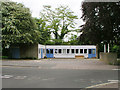
Photos of RH12 3WB
Area Information
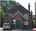
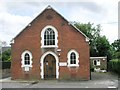
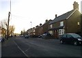
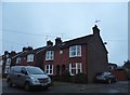
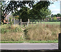
RH12 3WB is a small residential cluster with a population of 1149 residents. This postcode represents a tight-knit community situated in England, offering a domestic environment focused on privacy and settled living. The area is defined by its specific housing cluster rather than sprawling urban development. You will find a neighbourhood where people have put down deep roots, creating a stable atmosphere for families and individuals alike. Daily life here centres on the quiet convenience of a small community with direct access to broader services nearby. The compact nature of the postcode means you do not need to travel far for essential needs, yet the location provides a buffer from the denser parts of Horsham. Residents here enjoy a lifestyle characterised by lower population density compared to the wider borough. This specific residential area offers a calm alternative to the bustling town centres while maintaining efficient links to leisure and shopping. Living in RH12 3WB means you gain a quiet home base with immediate proximity to vital transport hubs and retail outlets.
- Area Type
- Postcode
- Area Size
- Not available
- Population
- 1149
- Population Density
- 5613 people/km²
The property market in RH12 3WB is defined by a traditional housing stock consisting entirely of houses. Because 81% of homes are owner-occupied, this is a solid territory for buyers looking to purchase a permanent family home rather than a rental or student property. The absence of flats or apartments indicates a focus on single-family living with private gardens and standalone entrances. This comprises a market where you can expect to buy standalone dwellings with established character typical of the region. The high ownership figure signals that properties have often been held across generations or by long-term professionals. You will not encounter a rental-heavy district typical of student zones or garrison towns. Instead, the housing market here responds to the needs of families and couples establishing households in a house rather than a flat. Buyers seeking a typical suburban property in England will find RH12 3WB fits their criteria perfectly.
House Prices in RH12 3WB
No properties found in this postcode.
Energy Efficiency in RH12 3WB
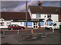
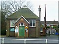
Residents of RH12 3WB benefit from practical access to several key amenities within a short practical reach. The retail sector offers five major outlets including The Southern Co-operative Co, Tesco Horsham, and Budgens Broadbridge. These stores provide comprehensive options for daily shopping and household supplies without needing a long journey to the main town centre. For travel, the area supports five railway connections, including Christ's Hospital Railway Station, Horsham Railway Station, and Warnham Railway Station. These stations facilitate easy commutes to London and other Greater London employers. You can combine your residential quiet with access to these transport hubs for work or leisure. Dining options are housed within the larger retail units, ensuring you have food choices nearby. The mix of supermarkets and railway stations means you can run errands and catch a train with minimal planning. This blend of accessible shops and rail links makes daily life straightforward for households located in RH12 3WB.
Amenities
Schools
| Rank | School | Type | Entry gender | Ages |
|---|
Explore more schools in this area
Go to Schools tabDemographics
The community in RH12 3WB is dominated by adults, with the most common age range spanning 30 to 64 years. Census figures show a median age of 47, indicating a mature population seeking stability rather than a youthful, fast-paced environment. Household ownership is strong, with 81% of residents owning their homes outright or with a mortgage. This high level of ownership suggests a deeply established community where people are likely to stay long term. The accommodation type is exclusively houses, meaning you will find detached, semi-detached, or terraced properties rather than flats or apartments. There are no high-rise developments or multi-unit buildings to disrupt the cohesive street pattern. The predominant ethnic group is White, reflecting the demographic makeup typical of this suburb. If you are looking for a household heavily centred on working-age adults, this area matches that profile precisely. The stability of the resident base creates a predictable environment for neighbours who value consistency over transient urban energy.
Household Size
Accommodation Type
Tenure
Ethnic Group
Religion
Household Composition
Age
Household Deprivation
NS-SEC
Explore more demographic insights in this area
Go to Demographics tabPlanning
Planning Constraints
- Flood RiskPremium
- Ramsar Wetland SitesPremium
- Area of Outstanding Natural BeautyPremium
- Protected Nature ReservePremium
- Protected WoodlandPremium