Area Overview for RH12 3RD
Photos of RH12 3RD


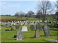
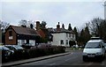
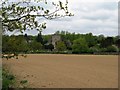
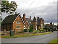
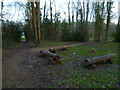
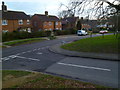
65 photos from this area
Area Information
Key information about the RH12 3RD including its size, population, and administrative classification.
- Area Type
- Postcode
- Area Size
- 4.6 hectares
- Population
- 2050
- Population Density
- 104 people/km²
House Prices in RH12 3RD
42
Properties
£269,913
Average Sold Price
£90,500
Lowest Price
£465,000
Highest Price
Showing 42 properties
| Address | Type | Beds | Baths | Last Sale Price | Last Sale Date | |
|---|---|---|---|---|---|---|
| 38 Tilletts Lane, Warnham, RH12 3RD | Maisonette | 2 | 1 | £270,000 | Apr 2023 | |
| 58 Tilletts Lane, Warnham, RH12 3RD | Flat | - | - | £187,000 | Feb 2022 | |
| 24 Tilletts Lane, Warnham, RH12 3RD | house | 3 | - | £366,000 | Oct 2021 | |
| 34 Tilletts Lane, Warnham, RH12 3RD | house | - | - | £300,000 | Sep 2021 | |
| 46 Tilletts Lane, Warnham, RH12 3RD | Semi-detached | 3 | 1 | £457,500 | May 2020 | |
| 50 Tilletts Lane, Warnham, RH12 3RD | Semi-detached | - | - | £180,000 | Mar 2017 | |
| 62 Tilletts Lane, Warnham, RH12 3RD | Flat | - | - | £189,950 | Sep 2014 | |
| 2 Tilletts Lane, Warnham, RH12 3RD | house | - | - | £465,000 | Aug 2014 | |
| 12 Tilletts Lane, Warnham, RH12 3RD | Terraced | 3 | 1 | £285,000 | Jul 2011 | |
| Oak Down, 38A Tilletts Lane, Warnham, RH12 3RD | Detached | 3 | 2 | £210,000 | Aug 2008 |
Page 1 of 5
Energy Efficiency in RH12 3RD
Amenities
Schools
| Rank | School | Type | Entry gender | Ages |
|---|
Explore more schools in this area
Go to Schools tabDemographics
Household Size
Two person
most common
Accommodation Type
Houses
most common
Tenure
72
majority
Ethnic Group
White
most common
Religion
N/A
most common
Household Composition
N/A
most common
Age
47
median
Adults (30-64 years)
most common
Household Deprivation
N/A
with no deprivation
NS-SEC
41
in Lower managerial occupations
Explore more demographic insights in this area
Go to Demographics tabPlanning
Planning Constraints
- Flood RiskPremium
- Ramsar Wetland SitesPremium
- Area of Outstanding Natural BeautyPremium
- Protected Nature ReservePremium
- Protected WoodlandPremium