Area Overview for RH12 3LP
Photos of RH12 3LP
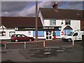
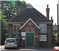


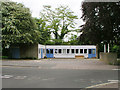
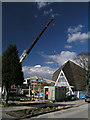

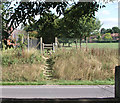
44 photos from this area
Area Information
Key information about the RH12 3LP including its size, population, and administrative classification.
- Area Type
- Postcode
- Area Size
- 1.9 hectares
- Population
- 1149
- Population Density
- 5613 people/km²
House Prices in RH12 3LP
26
Properties
£288,650
Average Sold Price
£65,000
Lowest Price
£855,000
Highest Price
Showing 26 properties
| Address | Type | Beds | Baths | Last Sale Price | Last Sale Date | |
|---|---|---|---|---|---|---|
| 70 Billingshurst Road, Broadbridge Heath, RH12 3LP | Semi-detached | 3 | 1 | £380,000 | Feb 2024 | |
| 104 Billingshurst Road, Broadbridge Heath, RH12 3LP | Detached | 4 | 1 | £570,000 | Aug 2023 | |
| 102 Billingshurst Road, Broadbridge Heath, RH12 3LP | Detached | 3 | - | £855,000 | Jun 2021 | |
| 98 Billingshurst Road, Broadbridge Heath, RH12 3LP | Detached | 3 | 1 | £465,000 | Nov 2019 | |
| 96 Billingshurst Road, Broadbridge Heath, RH12 3LP | house | - | - | £300,000 | Feb 2019 | |
| 64 Billingshurst Road, Broadbridge Heath, RH12 3LP | Semi-detached | 3 | 1 | £274,500 | Aug 2012 | |
| 76 Billingshurst Road, Broadbridge Heath, RH12 3LP | Semi-detached | 4 | - | £305,000 | Jul 2011 | |
| 56 Billingshurst Road, Broadbridge Heath, RH12 3LP | house | 3 | - | £280,000 | Apr 2011 | |
| 66 Billingshurst Road, Broadbridge Heath, RH12 3LP | Semi-detached | - | - | £225,000 | Mar 2009 | |
| 90 Billingshurst Road, Broadbridge Heath, RH12 3LP | house | - | - | £322,500 | Nov 2007 |
Page 1 of 3
Energy Efficiency in RH12 3LP
Amenities
Schools
| Rank | School | Type | Entry gender | Ages |
|---|
Explore more schools in this area
Go to Schools tabDemographics
Household Size
Family (3-5 people)
most common
Accommodation Type
Houses
most common
Tenure
81
majority
Ethnic Group
White
most common
Religion
N/A
most common
Household Composition
N/A
most common
Age
47
median
Adults (30-64 years)
most common
Household Deprivation
N/A
with no deprivation
NS-SEC
36
in Lower managerial occupations
Explore more demographic insights in this area
Go to Demographics tabPlanning
Planning Constraints
- Flood RiskPremium
- Ramsar Wetland SitesPremium
- Area of Outstanding Natural BeautyPremium
- Protected Nature ReservePremium
- Protected WoodlandPremium