Area Overview for RH12 3LF
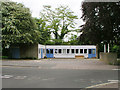
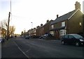
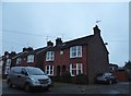
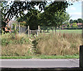
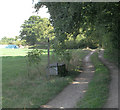
Photos of RH12 3LF
Area Information
Living in RH12 3LF means residing within a compact residential cluster defined by postcode boundaries. This specific area covers just 3025 square metres, creating a dense and focused neighbourhood environment. With a population of 2097 people, the community operates on a local scale where daily interactions remain relatively close-knit. You live in an English locality where every street corner contributes to the identity of this distinct postcode. The area functions as a dedicated residential zone, separate from larger commercial or industrial hubs. Residents benefit from a clear sense of place within Horsham's wider catchment. The small footprint ensures that services are often within walking or cycling distance. Buying a home here guarantees a specific micro-location rather than a broad region. The density of 693125 people per square kilometre reflects the tightly packed nature of this postcode. You are part of a tight group of neighbours who share immediate proximity. Daily life revolves around the practicalities of this concentrated residential pocket. The area offers a straightforward living arrangement without the sprawl of larger developments. Your home address anchors you firmly within this recognised residential cluster.
- Area Type
- Postcode
- Area Size
- 3025 m²
- Population
- 2097
- Population Density
- 3471 people/km²
The housing market in RH12 3LF is characterised by a strong preference for ownership and traditional residential forms. Sixty-seven percent of homes in this postcode are owner-occupied, indicating a robust primary market rather than a rental-dominated zone. The accommodation type catalogue features houses exclusively, offering buyers a consistent product free from the variability found in apartment complexes. Prospective homebuyers face a market where the stock consists primarily of owned properties with established community ties. This high ownership percentage suggests that families have anchored themselves in the area over time. Houses predominate in the streets, meaning you can expect conventional pitched roofs and garden spaces rather than balconies or communal corridors. The residential nature of the cluster excludes large-scale student housing or social housing projects. Buyers looking at RH12 3LF encounter a uniform housing stock defined by its house-based architecture. The 3025 square metre footprint limits inventory to a small number of transactions at any given time. This scarcity means that purchasing a home here requires a decisive approach. Your property purchase will contribute to a landscape where owners have vested interests in maintaining property values. The market operates with the rhythm of independent homeowners rather than institutional landlords. Access to homes in RH12 3LF hinges on the availability of private residential listings within this tiny cluster.
House Prices in RH12 3LF
Showing 3 properties
| Address | Type | Beds | Baths | Last Sale Price | Last Sale Date | |
|---|---|---|---|---|---|---|
| 3 The Orchards, Broadbridge Heath, RH12 3LF | Detached | - | - | £395,000 | Jul 2007 | |
| 1 The Orchards, Broadbridge Heath, RH12 3LF | Detached | - | - | £176,000 | Feb 1998 | |
| 2 The Orchards, Broadbridge Heath, RH12 3LF | house | - | - | - | - |
Energy Efficiency in RH12 3LF
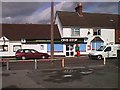
Daily life in RH12 3LF integrates practical amenities within a short radius of your home. Retail options include The Southern Co-operative Co, Budgens Broadbridge, and Tesco Horsham, providing comprehensive grocery and shopping needs. These five retail venues offer a full range of household supplies from fresh produce to household goods. For those prioritising rail access, five stations lie within practical reach including Christs Hospital Railway Station, Horsham Railway Station, and Warnham Railway Station. These rail links connect residents to wider transportation networks for commuting or leisure travel. The presence of Tesco Horsham suggests a high-street shopping experience with established brands nearby. You can access daily essentials during standard working hours without significant travel time. Travel to Horsham Railway Station expands your options for train journeys to London or the South Coast. The Southern Co-operative Co provides an alternative retail choice fitting community values. Five nearby amenities ensure that your errands rarely require long drives. Children can access school runs easily given the compact nature of the cluster. Shopping and transport nodes surround the residential patch to enhance convenience. You live amidst a functional landscape where work, food, and travel intersect efficiently.
Amenities
Schools
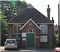
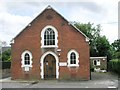
Educational provision for families living in RH12 3LF includes Shelley Primary School as a key local institution. The school operates at a good Ofsted rating, reflecting a standard of quality recognised by national regulators. Shelley Primary School serves as the primary educational contact for younger children in the immediate vicinity. With a school population limited to this single venue within the data scope, families often rely on the main stream for early education. The good rating provides a solid foundation for child development within the local catchment. This educational offering supports the demographic profile of adults aged 30 to 64 who require schooling for their dependants. The presence of a good-rated primary school suggests that residential planning supports family needs. Parents in the area have access to a verified educational standard without the need to commute to distant institutions. The limited school data implies a focus on primary education within this specific postcode boundary. You do not have detailed secondary school information embedded in the local dataset for RH12 3LF. Consequently, the local childhood experience centres heavily around the primary stage before potential moves to wider borough schools. The proximity of Shelley Primary School integrates education into the daily rhythm of neighbourhood life. School transport arrangements often utilise the short distances available in a 3025 square metre cluster.
| Rank | School | Type | Entry gender | Ages |
|---|
Explore more schools in this area
Go to Schools tabDemographics
The community profile of RH12 3LF reflects an established residential sector with pronounced stability. The median age of 47 years indicates a settled population where long-term residents form the backbone of the local society. Most residents fall into the 30 to 64 years age range, signifying a workforce-oriented neighbourhood occupying the middle years of adult life. Home ownership stands at 67%, demonstrating a high level of residential commitment and financial investment in the area. The prevailing accommodation type consists of houses, shaping the physical streetscape with detached or semi-detached properties rather than high-rise blocks. Ethnic diversity is dominated by a White population, aligning with broader national trends in this part of the UK. This demographic structure suggests a family-friendly environment where household units operate with relative consistency. The high ownership rate implies a low turnover of tenants and a community familiar with its immediate surroundings. Residents likely have deep local knowledge regarding the area's specific streets and amenities. The absence of significant rental proportions points to a stable, owner-occupied market where family units typically remain for extended periods. This demographic reality influences the tone of local governance and community engagement. You are purchasing into a established group of homeowners who prioritise domestic stability.
Household Size
Accommodation Type
Tenure
Ethnic Group
Religion
Household Composition
Age
Household Deprivation
NS-SEC
Explore more demographic insights in this area
Go to Demographics tabPlanning
Planning Constraints
- Flood RiskPremium
- Ramsar Wetland SitesPremium
- Area of Outstanding Natural BeautyPremium
- Protected Nature ReservePremium
- Protected WoodlandPremium