Area Overview for RH12 3GN
Photos of RH12 3GN
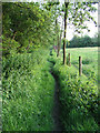
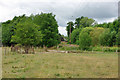
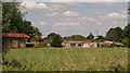
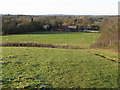

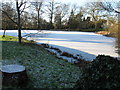
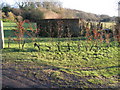
32 photos from this area
Area Information
Key information about the RH12 3GN including its size, population, and administrative classification.
- Area Type
- Postcode
- Area Size
- 1.0 hectares
- Population
- 1799
- Population Density
- 1684 people/km²
House Prices in RH12 3GN
25
Properties
£447,725
Average Sold Price
£290,000
Lowest Price
£687,500
Highest Price
Showing 25 properties
| Address | Type | Beds | Baths | Last Sale Price | Last Sale Date | |
|---|---|---|---|---|---|---|
| 38 Heydon Way, Broadbridge Heath, RH12 3GN | house | - | - | £630,000 | Mar 2024 | |
| 4 Heydon Way, Broadbridge Heath, RH12 3GN | Terraced | 3 | 1 | £470,000 | Aug 2023 | |
| 46 Heydon Way, Broadbridge Heath, RH12 3GN | Detached | 3 | 2 | £518,000 | Oct 2022 | |
| 28 Heydon Way, Broadbridge Heath, RH12 3GN | Terraced | 2 | 2 | £348,500 | Sep 2022 | |
| 24 Heydon Way, Broadbridge Heath, RH12 3GN | Retail | 4 | 2 | £515,000 | May 2022 | |
| 10 Heydon Way, Broadbridge Heath, RH12 3GN | Flat | 2 | 2 | £305,000 | Apr 2022 | |
| 6 Heydon Way, Broadbridge Heath, RH12 3GN | house | - | - | £400,000 | Jun 2021 | |
| 16 Heydon Way, Broadbridge Heath, RH12 3GN | Detached | 4 | - | £458,000 | Dec 2020 | |
| 18 Heydon Way, Broadbridge Heath, RH12 3GN | Detached | 4 | 3 | £490,000 | Feb 2019 | |
| 32 Heydon Way, Broadbridge Heath, RH12 3GN | Semi-detached | 4 | 2 | £465,000 | Apr 2018 |
Page 1 of 3
Energy Efficiency in RH12 3GN
Amenities
Schools
| Rank | School | Type | Entry gender | Ages |
|---|
Explore more schools in this area
Go to Schools tabDemographics
Household Size
Family (3-5 people)
most common
Accommodation Type
Houses
most common
Tenure
78
majority
Ethnic Group
White
most common
Religion
N/A
most common
Household Composition
N/A
most common
Age
47
median
Adults (30-64 years)
most common
Household Deprivation
N/A
with no deprivation
NS-SEC
53
in Lower managerial occupations
Explore more demographic insights in this area
Go to Demographics tabPlanning
Planning Constraints
- Flood RiskPremium
- Ramsar Wetland SitesPremium
- Area of Outstanding Natural BeautyPremium
- Protected Nature ReservePremium
- Protected WoodlandPremium