Area Overview for RH12 1XP
Photos of RH12 1XP
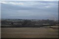
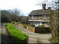
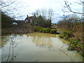
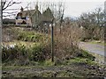
27 photos from this area
Area Information
Key information about the RH12 1XP including its size, population, and administrative classification.
- Area Type
- Postcode
- Area Size
- 1.1 hectares
- Population
- 1640
- Population Density
- 4283 people/km²
House Prices in RH12 1XP
25
Properties
£206,364
Average Sold Price
£82,950
Lowest Price
£295,000
Highest Price
Showing 25 properties
| Address | Type | Beds | Baths | Last Sale Price | Last Sale Date | |
|---|---|---|---|---|---|---|
| 10 Parsons Walk, Horsham, RH12 1XP | Terraced | 3 | - | £295,000 | Nov 2018 | |
| 31 Parsons Walk, Horsham, RH12 1XP | house | - | - | £278,000 | Apr 2016 | |
| 35 Parsons Walk, Horsham, RH12 1XP | Terraced | 3 | 1 | £259,950 | Sep 2015 | |
| 33 Parsons Walk, Horsham, RH12 1XP | house | - | - | £262,100 | Jun 2015 | |
| 12 Parsons Walk, Horsham, RH12 1XP | Terraced | 3 | 1 | £250,000 | Aug 2014 | |
| 37 Parsons Walk, Horsham, RH12 1XP | Terraced | 3 | 1 | £175,000 | Mar 2009 | |
| 6 Parsons Walk, Horsham, RH12 1XP | Terraced | - | - | £176,000 | Aug 2006 | |
| 27 Parsons Walk, Horsham, RH12 1XP | Semi-detached | - | - | £180,000 | Dec 2005 | |
| 1 Parsons Walk, Horsham, RH12 1XP | Semi-detached | - | - | £227,500 | May 2004 | |
| 2 Parsons Walk, Horsham, RH12 1XP | Terraced | 3 | - | £82,950 | Aug 1998 |
Page 1 of 3
Energy Efficiency in RH12 1XP
Amenities
Schools
| Rank | School | Type | Entry gender | Ages |
|---|
Explore more schools in this area
Go to Schools tabDemographics
Household Size
Family (3-5 people)
most common
Accommodation Type
Houses
most common
Tenure
59
majority
Ethnic Group
White
most common
Religion
N/A
most common
Household Composition
N/A
most common
Age
47
median
Adults (30-64 years)
most common
Household Deprivation
N/A
with no deprivation
NS-SEC
36
in Lower managerial occupations
Explore more demographic insights in this area
Go to Demographics tabPlanning
Planning Constraints
- Flood RiskPremium
- Ramsar Wetland SitesPremium
- Area of Outstanding Natural BeautyPremium
- Protected Nature ReservePremium
- Protected WoodlandPremium