Area Overview for RH12 1NX
Photos of RH12 1NX
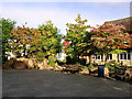
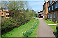
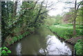
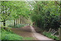
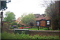
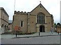
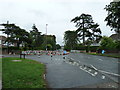
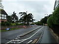
100 photos from this area
Area Information
Key information about the RH12 1NX including its size, population, and administrative classification.
- Area Type
- Postcode
- Area Size
- 1.3 hectares
- Population
- 1759
- Population Density
- 4584 people/km²
House Prices in RH12 1NX
20
Properties
£416,609
Average Sold Price
£105,000
Lowest Price
£667,000
Highest Price
Showing 20 properties
| Address | Type | Beds | Baths | Last Sale Price | Last Sale Date | |
|---|---|---|---|---|---|---|
| 5 Riverside, Horsham, RH12 1NX | Detached | 3 | 2 | £570,000 | Dec 2025 | |
| 17 Riverside, Horsham, RH12 1NX | Detached | 3 | 2 | £515,000 | Apr 2025 | |
| 15 Riverside, Horsham, RH12 1NX | Detached | 3 | 2 | £560,000 | Jan 2025 | |
| 9 Riverside, Horsham, RH12 1NX | Detached | 4 | 2 | £570,000 | Jan 2024 | |
| 19 Riverside, Horsham, RH12 1NX | Detached | 4 | 2 | £667,000 | Feb 2023 | |
| 6 Riverside, Horsham, RH12 1NX | Detached | 3 | 2 | £665,900 | Nov 2022 | |
| 16 Riverside, Horsham, RH12 1NX | house | - | - | £465,000 | May 2021 | |
| 7 Riverside, Horsham, RH12 1NX | Detached | 3 | 1 | £425,000 | May 2019 | |
| 8 Riverside, Horsham, RH12 1NX | house | - | - | £390,000 | Dec 2017 | |
| 11 Riverside, Horsham, RH12 1NX | Detached | 4 | - | £490,000 | Oct 2015 |
Page 1 of 2
Energy Efficiency in RH12 1NX
Amenities
Schools
| Rank | School | Type | Entry gender | Ages |
|---|
Explore more schools in this area
Go to Schools tabDemographics
Household Size
Two person
most common
Accommodation Type
Houses
most common
Tenure
78
majority
Ethnic Group
White
most common
Religion
N/A
most common
Household Composition
N/A
most common
Age
47
median
Adults (30-64 years)
most common
Household Deprivation
N/A
with no deprivation
NS-SEC
43
in Lower managerial occupations
Explore more demographic insights in this area
Go to Demographics tabPlanning
Planning Constraints
- Flood RiskPremium
- Ramsar Wetland SitesPremium
- Area of Outstanding Natural BeautyPremium
- Protected Nature ReservePremium
- Protected WoodlandPremium