Area Overview for RH11 9LQ
Photos of RH11 9LQ


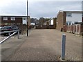
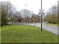
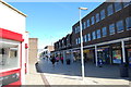
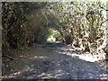

100 photos from this area
Area Information
Key information about the RH11 9LQ including its size, population, and administrative classification.
- Area Type
- Postcode
- Area Size
- 9567 m²
- Population
- 1834
- Population Density
- 3948 people/km²
House Prices in RH11 9LQ
12
Properties
£138,168
Average Sold Price
£26,700
Lowest Price
£290,000
Highest Price
Showing 12 properties
| Address | Type | Beds | Baths | Last Sale Price | Last Sale Date | |
|---|---|---|---|---|---|---|
| 8, Adrian Court, Chadwick Close, Broadfield, Crawley, RH11 9LQ | house | - | - | £290,000 | May 2021 | |
| 9, Adrian Court, Chadwick Close, Broadfield, Crawley, RH11 9LQ | Terraced | 3 | 1 | £172,310 | Nov 2010 | |
| 1, Adrian Court, Chadwick Close, Broadfield, Crawley, RH11 9LQ | Terraced | - | - | £162,000 | Aug 2005 | |
| 12, Adrian Court, Chadwick Close, Broadfield, Crawley, RH11 9LQ | Terraced | - | - | £140,000 | Sep 2003 | |
| 2, Adrian Court, Chadwick Close, Broadfield, Crawley, RH11 9LQ | Terraced | - | - | £26,700 | Feb 1997 | |
| 5, Adrian Court, Chadwick Close, Broadfield, Crawley, RH11 9LQ | Terraced | - | - | £38,000 | Jan 1997 | |
| 7, Adrian Court, Chadwick Close, Broadfield, Crawley, RH11 9LQ | Terraced | - | - | - | - | |
| 10, Adrian Court, Chadwick Close, Broadfield, Crawley, RH11 9LQ | house | - | - | - | - | |
| 11, Adrian Court, Chadwick Close, Broadfield, Crawley, RH11 9LQ | house | - | - | - | - | |
| 6, Adrian Court, Chadwick Close, Broadfield, Crawley, RH11 9LQ | house | - | - | - | - |
Page 1 of 2
Energy Efficiency in RH11 9LQ
Amenities
Schools
| Rank | School | Type | Entry gender | Ages |
|---|
Explore more schools in this area
Go to Schools tabDemographics
Household Size
One person
most common
Accommodation Type
Houses
most common
Tenure
57
majority
Ethnic Group
White
most common
Religion
N/A
most common
Household Composition
N/A
most common
Age
47
median
Adults (30-64 years)
most common
Household Deprivation
N/A
with no deprivation
NS-SEC
29
in Lower managerial occupations
Explore more demographic insights in this area
Go to Demographics tabPlanning
Planning Constraints
- Flood RiskPremium
- Ramsar Wetland SitesPremium
- Area of Outstanding Natural BeautyPremium
- Protected Nature ReservePremium
- Protected WoodlandPremium