Area Overview for RH11 8TY
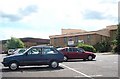
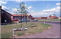
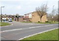
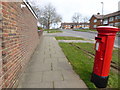
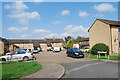
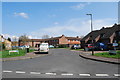
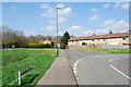
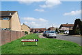
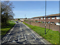
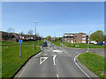
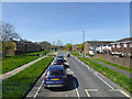
Photos of RH11 8TY
Area Information
Living in RH11 8TY means residing within a small residential cluster that covers just 3609 square metres. This postcode serves a population of 2314 people, creating a tightly knit environment where neighbours are often within eyesight of one another. The area functions as a quiet pocket of the wider Crawley district, offering a sense of privacy despite its compact size. Daily life here revolves around the specific needs of a mature community, with access to local amenities and transport hubs playing a central role in household routines. The layout of this postcode area reflects a design focused on housing rather than commercial enterprise or industrial activity. Residents find themselves in a setting that balances quiet solitude with necessary proximity to larger services found in nearby Crawley. The character of RH11 8TY is defined by its residential density and the specific demographic profile of those who chose to make it their home. With a median age of 47, the residents here generally seek stability and quieter surroundings rather than the fast pace of city living. You will find a community where the majority of homes are houses, catering to families and individuals who prefer ground-floor contact with their gardens or street. While the total area is small, the sheer concentration of 2314 inhabitants ensures that no one is truly isolated from the local community. The neighbourhood operates with a distinct rhythm, driven by the schedules of commuters using the nearby rail stations and the needs of a predominantly home-owning population. This creates a stable environment where long-term residents know the street map and the local habits of those around them.
- Area Type
- Postcode
- Area Size
- 3609 m²
- Population
- 2314
- Population Density
- 6321 people/km²
The property market in RH11 8TY is characterised by a strong leaning towards owner-occupiers, with 55% of households owning their homes. This figure indicates a stable market where residents are less likely to move frequently compared to rental-dominant regions. The accommodation type for this postcode is listed as houses, meaning the building stock focuses on detached or semi-detached properties rather than flats or terraced townhomes. You will find a neighbourhood where buyers are looking for genuine living space, likely involving gardens and private entrances, rather than the compact living found in urban blocks. This concentration of houses and high ownership suggests a market where property values are influenced by specific household needs rather than short-term rental yields. Prospective buyers entering RH11 8TY encounter a landscape of residential clusters designed for family life. The small size of the area, at only 3609 square metres, means that the market is tight and possibly niche, with fewer properties available at any given moment. Because the area is a specific residential cluster, inventory may remain low, making the purchase of a home here a somewhat exclusive opportunity. The 55% ownership rate implies that a significant portion of the housing stock is on the ladder with minimal turning over. If you are looking to buy, you are likely joining a group of residents who have put down roots and view their homes as a long-term asset rather than a temporary base.
House Prices in RH11 8TY
No properties found in this postcode.
Energy Efficiency in RH11 8TY
Daily life in RH11 8TY benefits from a cluster of retail and transport amenities located within practical reach. Five retail outlets are situated nearby, including Morrisons Daily and Co-op Crawley, ensuring you can handle grocery shopping and daily essentials without travelling far. For entertainment or extended dining, the area is heavily oriented towards air travel and major transport hubs, evidenced by the presence of London Gatwick Airport nearby. This proximity offers a lifestyle of convenience for frequent flyers or those working in the aviation sector. Two metro shuttle stations, Gatwick North Terminal Shuttle Station and Gatwick South Terminal Shuttle Station, provide easy access to the terminals, and the South Terminal Coach Station serves as a key bus hub. The lifestyle here is defined by accessibility to major transport infrastructure. Residents can combine local shopping at the named supermarkets with immediate access to long-distance travel. Ifield Railway Station, Crawley Railway Station, and Faygate Railway Station offer additional transport flexibility if driving to the airport is inconvenient. The area does not feature a large array of leisure parks or traditional town centres within the immediate 3609 square metres, but the transport links compensate by bringing the wider world of entertainment and commerce to your doorstep. Shopping for daily needs is simple with Morrisons Daily and Co-op Crawley in close proximity. For those who value travel as part of their lifestyle, being near London Gatwick Airport is a distinct advantage. The amenities available create a functional environment where you can manage domestic chores and international travel from the same residential base.
Amenities
Schools
The educational landscape immediately surrounding RH11 8TY is anchored by Hilltop Primary School, a primary institution serving the younger pupils in the vicinity. This is the only specific school named in the data for this immediate postcode. Although no secondary schools are listed in the provided details for this specific cluster, the presence of Hilltop Primary indicates that families with young children rely on this facility for early education. For older pupils, families living in RH11 8TY would typically look to secondary institutions in the broader Crawley area, as primary schools alone do not cover the full educational pathway. Living in RH11 8TY places you within reach of at least one established primary education provider. Hilltop Primary School offers a foundational step in the local community's infrastructure. While you cannot access a full list of nearby secondary schools or their specific Ofsted ratings from the current data, the existence of a named primary school confirms a commitment to early childhood learning. The school type is primary, meaning it caters to students who have not yet entered the teenage years. Families considering this area must be aware that while primary education is covered by Hilltop Primary, secondary education requires travel to a wider catchment. The proximity of Hilltop Primary provides a convenient starting point for school run logistics before children move on to teenage education elsewhere in the district.
| Rank | School | Type | Entry gender | Ages |
|---|
Explore more schools in this area
Go to Schools tabDemographics
The community in RH11 8TY displays a clear demographic profile centred on adults between the ages of 30 and 64 years. The median age sits at 47, which positions this area firmly within the demographic group of established adults. This age distribution suggests a neighbourhood that has matured over time, attracting those who have moved beyond their twenties into a phase of life defined by career establishment or full-time parenting. Such residents typically prioritise security and established neighbourhoods over trendy developments. Consequently, the area holds a high home ownership rate of 55%, indicating that more than half of the houses here are owned outright or with a mortgage, rather than being rented properties. House ownership in RH11 8TY creates a community with significant investment in its local stability. When residents own their homes, they are more likely to maintain the property and engage with neighbours, fostering a predictable social environment. The predominant ethnic group is White, which aligns with the broader demographic trends of the surrounding county. The area consists almost entirely of houses, meaning townhouses or detached family units form the backbone of the streetscape. This housing style supports the needs of the adult age range, providing ample space for growing families or empty nesters. The combination of a 47-year-old median age and strong ownership rates points to a settled populace that values continuity. Liveable spaces here cater specifically to those in the middle and later stages of life, avoiding the distraction of large student populations or transient rental turnover.
Household Size
Accommodation Type
Tenure
Ethnic Group
Religion
Household Composition
Age
Household Deprivation
NS-SEC
Explore more demographic insights in this area
Go to Demographics tabPlanning
Planning Constraints
- Flood RiskPremium
- Ramsar Wetland SitesPremium
- Area of Outstanding Natural BeautyPremium
- Protected Nature ReservePremium
- Protected WoodlandPremium