Area Overview for RH11 8HR
Photos of RH11 8HR
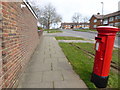
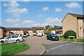
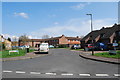
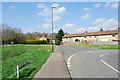
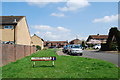
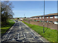
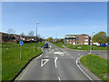
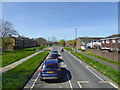
80 photos from this area
Area Information
Key information about the RH11 8HR including its size, population, and administrative classification.
- Area Type
- Postcode
- Area Size
- 2833 m²
- Population
- 2314
- Population Density
- 6321 people/km²
House Prices in RH11 8HR
11
Properties
£231,650
Average Sold Price
£94,950
Lowest Price
£380,000
Highest Price
Showing 11 properties
| Address | Type | Beds | Baths | Last Sale Price | Last Sale Date | |
|---|---|---|---|---|---|---|
| 19 Buckswood Drive, Gossops Green, Crawley, RH11 8HR | Terraced | 6 | 2 | £380,000 | Nov 2022 | |
| 9 Buckswood Drive, Gossops Green, Crawley, RH11 8HR | Maisonette | 2 | 1 | £220,000 | Jan 2017 | |
| 11 Buckswood Drive, Gossops Green, Crawley, RH11 8HR | Flat | - | - | £94,950 | Aug 2002 | |
| Annexe At, 180 Buckswood Drive, Gossops Green, Crawley, RH11 8HR | Flat | - | - | - | - | |
| 13 Buckswood Drive, Gossops Green, Crawley, RH11 8HR | house | - | - | - | - | |
| 5 Buckswood Drive, Gossops Green, Crawley, RH11 8HR | Flat | - | - | - | - | |
| 17 Buckswood Drive, Gossops Green, Crawley, RH11 8HR | Terraced | - | - | - | - | |
| 1 Buckswood Drive, Gossops Green, Crawley, RH11 8HR | Flat | - | - | - | - | |
| 3 Buckswood Drive, Gossops Green, Crawley, RH11 8HR | Flat | - | - | - | - | |
| 15 Buckswood Drive, Gossops Green, Crawley, RH11 8HR | Terraced | - | - | - | - |
Page 1 of 2
Energy Efficiency in RH11 8HR
Amenities
Schools
| Rank | School | Type | Entry gender | Ages |
|---|
Explore more schools in this area
Go to Schools tabDemographics
Household Size
Family (3-5 people)
most common
Accommodation Type
Houses
most common
Tenure
55
majority
Ethnic Group
White
most common
Religion
N/A
most common
Household Composition
N/A
most common
Age
47
median
Adults (30-64 years)
most common
Household Deprivation
N/A
with no deprivation
NS-SEC
25
in Lower managerial occupations
Explore more demographic insights in this area
Go to Demographics tabPlanning
Planning Constraints
- Flood RiskPremium
- Ramsar Wetland SitesPremium
- Area of Outstanding Natural BeautyPremium
- Protected Nature ReservePremium
- Protected WoodlandPremium