Area Overview for RH11 7TR
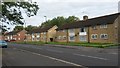
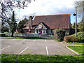
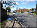
Photos of RH11 7TR
Area Information
Living in RH11 7TR means residing within a tightly defined residential cluster covering just under 0.01 square kilometres. This small postcode serves approximately 1,859 people in a setting that is physically compact yet well-connected to wider Croydon and the broader South London network. The area functions as a specific residential node where daily life revolves around proximity to major transport links while maintaining a contained living environment. You are part of a community where the physical space is limited, creating a neighbourhood that feels intimate despite its small geographic footprint. Residents here navigate a landscape that prioritises immediate access to services rather than sprawling suburban gardens. The population density places significant weight on the infrastructure supporting these homes, ensuring that everything from retail outlets to rail links is within a short walk or drive. Buying a home in RH11 7TR offers a degree of seclusion within a highly serviced zone. The area acts as a quiet stop-off point for those commuting to London or working locally, providing a base that balances convenience with restricted space. You live in an environment defined by its precision and its close integration with the wider transport network surrounding Croydon Rail Station.
- Area Type
- Postcode
- Area Size
- 9774 m²
- Population
- 1859
- Population Density
- 8299 people/km²
The property market in RH11 7TR is characterised by a specific housing stock where houses dominate the landscape. Only 46% of residents own their homes, suggesting that a significant portion of the housing stock is available on the rental market. This statistic means you are likely to encounter both owner-occupied properties and investment rentals when searching for homes in this postcode. The predominant accommodation type is houses, which aligns with the family-oriented nature of the 30 to 64 year old demographic. You can expect to find a market driven by practical living spaces rather than high-rise developments or luxury conversions. The relatively low homeownership rate of 46% indicates that buying here might require competitive effort or specific financing, as supply is not entirely exhausted by current owners. Prospective buyers should consider that the area is a mix of owner-occupied homes and letted properties. This dynamic creates a stable tenant base but also implies that property prices may reflect the supply-and-demand balance between the 46% of owners and the majority of renters. The market remains functional and straightforward, focusing on the physical houses that provide housing for the nearly 1,900 residents who call this small postcode home.
House Prices in RH11 7TR
Showing 27 properties
| Address | Type | Beds | Baths | Last Sale Price | Last Sale Date | |
|---|---|---|---|---|---|---|
| 105 Denchers Plat, Langley Green, Crawley, RH11 7TR | house | - | - | £322,500 | Mar 2023 | |
| 97 Denchers Plat, Langley Green, Crawley, RH11 7TR | Terraced | 3 | 1 | £270,000 | Oct 2022 | |
| 59 Denchers Plat, Langley Green, Crawley, RH11 7TR | Semi-detached | 3 | 1 | £388,000 | Jan 2022 | |
| 93 Denchers Plat, Langley Green, Crawley, RH11 7TR | Terraced | 3 | 1 | £290,000 | Dec 2021 | |
| 69 Denchers Plat, Langley Green, Crawley, RH11 7TR | Terraced | 3 | - | £320,000 | Feb 2020 | |
| 103 Denchers Plat, Langley Green, Crawley, RH11 7TR | Terraced | 3 | 1 | £263,000 | Nov 2016 | |
| 77 Denchers Plat, Langley Green, Crawley, RH11 7TR | house | - | - | £189,950 | Aug 2013 | |
| 109 Denchers Plat, Langley Green, Crawley, RH11 7TR | house | - | - | £160,000 | May 2013 | |
| 81 Denchers Plat, Langley Green, Crawley, RH11 7TR | house | 3 | - | £170,000 | Jun 2012 | |
| 75 Denchers Plat, Langley Green, Crawley, RH11 7TR | Terraced | 3 | 1 | £150,000 | Dec 2010 |
Energy Efficiency in RH11 7TR
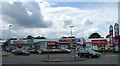
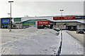
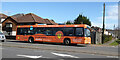
Residents of RH11 7TR benefit from a variety of amenities within practical reach, offering convenience without requiring a long car journey. There are five retail outlets nearby, including Co-op Langley, Sainsburys West, and Aldi Manor. These shops provide everyday necessities like groceries and essentials directly to your doorstep. Transport links are equally impressive, with five rail stations accessible inside the area, including Crawley, Ifield, and Three Bridges Railway Station. Two major airports, both listed as London Gatwick, sit nearby, facilitating travel across the globe. Additionally, two metro stations for the Gatwick terminal shuttles and one bus station provide comprehensive public transport options. You can reach Gatwick North and South Terminal Shuttle Stations easily from your front door. This dense network of services means you rarely need a car for routine tasks. The presence of these five retail sites and transportation hubs ensures that your daily life involves little travel and maximum convenience. Whether you need fresh food or a train ticket, everything is close by.
Amenities
Schools
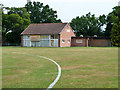
Families living in RH11 7TR have access to a primary school that meets high educational standards. Langley Green Primary is the only school listed in the immediate vicinity, and it holds a 'good' Ofsted rating. This single academy option provides a consistent educational backdrop for children attending school near this postcode. The presence of a 'good' rated primary school suggests that the local authority has secured an institution capable of delivering quality education to the local children. There are no secondary schools listed in the provided data for immediate reference, which implies that older children may travel further for secondary education. The proximity of Langley Green Primary makes it a key consideration for parents moving into this area. You do not have to commute far to ensure your children receive an education recognised for its quality. The school environment supports the demographic mix of children and families found within the 30 to 64 year old age bracket. For those prioritising education, the availability of Langley Green Primary provides a reliable local option without the need for long-term travel to larger cities.
| Rank | School | Type | Entry gender | Ages |
|---|
Explore more schools in this area
Go to Schools tabDemographics
The community profile in RH11 7TR reflects a mature demographic settled in this postcode over many years. Your neighbours are primarily adults aged between 30 and 64 years, with the median age sitting at 47 years old. This indicates a stable population where families and established professionals have built their lives in the area. Home ownership stands at 46%, marking a split where roughly half of the residents rent rather than own their dwellings. This balance suggests a mix of long-term owners and tenants who have chosen to settle in the locality. The accommodation type data confirms that houses are the predominant form of housing available here, rather than apartments or flats. Demographically, the White ethnic group forms the predominant population, shaping the cultural fabric of the neighbourhood. You are买入ing into a settled community where the social norm leans towards house living and family stability. The age structure implies that schools remain relevant for younger families, while the middle-age majority likely includes empty nesters or young professionals establishing households. The homeownership rate of 46% provides a clear picture of wealth distribution and market dynamics within this small cluster.
Household Size
Accommodation Type
Tenure
Ethnic Group
Religion
Household Composition
Age
Household Deprivation
NS-SEC
Explore more demographic insights in this area
Go to Demographics tabPlanning
Planning Constraints
- Flood RiskPremium
- Ramsar Wetland SitesPremium
- Area of Outstanding Natural BeautyPremium
- Protected Nature ReservePremium
- Protected WoodlandPremium