Area Overview for RH11 7RG
Photos of RH11 7RG
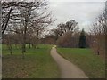
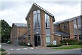
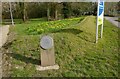
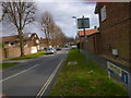
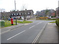
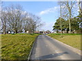

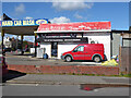
100 photos from this area
Area Information
Key information about the RH11 7RG including its size, population, and administrative classification.
- Area Type
- Postcode
- Area Size
- 1.6 hectares
- Population
- 1842
- Population Density
- 5973 people/km²
House Prices in RH11 7RG
26
Properties
£213,133
Average Sold Price
£73,000
Lowest Price
£313,000
Highest Price
Showing 26 properties
| Address | Type | Beds | Baths | Last Sale Price | Last Sale Date | |
|---|---|---|---|---|---|---|
| 18 Jackdaw Close, Langley Green, Crawley, RH11 7RG | Terraced | 3 | 1 | £313,000 | Jul 2022 | |
| 12 Jackdaw Close, Langley Green, Crawley, RH11 7RG | Terraced | 3 | 1 | £293,000 | Jun 2021 | |
| 3 Jackdaw Close, Langley Green, Crawley, RH11 7RG | house | - | - | £285,000 | May 2021 | |
| 19 Jackdaw Close, Langley Green, Crawley, RH11 7RG | Terraced | 3 | 1 | £272,000 | Oct 2019 | |
| 9 Jackdaw Close, Langley Green, Crawley, RH11 7RG | Terraced | 3 | 1 | £263,000 | Oct 2017 | |
| 5 Jackdaw Close, Langley Green, Crawley, RH11 7RG | Terraced | 3 | 1 | £288,500 | Jun 2017 | |
| 4 Jackdaw Close, Langley Green, Crawley, RH11 7RG | house | 1 | 1 | £270,000 | Feb 2017 | |
| 17 Jackdaw Close, Langley Green, Crawley, RH11 7RG | Terraced | 3 | - | £230,000 | Jul 2014 | |
| 25 Jackdaw Close, Langley Green, Crawley, RH11 7RG | Terraced | 3 | 1 | £197,000 | Nov 2013 | |
| 20 Jackdaw Close, Langley Green, Crawley, RH11 7RG | house | - | - | £100,000 | Dec 2011 |
Page 1 of 3
Energy Efficiency in RH11 7RG
Amenities
Schools
| Rank | School | Type | Entry gender | Ages |
|---|
Explore more schools in this area
Go to Schools tabDemographics
Household Size
Family (3-5 people)
most common
Accommodation Type
Houses
most common
Tenure
46
majority
Ethnic Group
White
most common
Religion
N/A
most common
Household Composition
N/A
most common
Age
47
median
Adults (30-64 years)
most common
Household Deprivation
N/A
with no deprivation
NS-SEC
19
in Lower managerial occupations
Explore more demographic insights in this area
Go to Demographics tabPlanning
Planning Constraints
- Flood RiskPremium
- Ramsar Wetland SitesPremium
- Area of Outstanding Natural BeautyPremium
- Protected Nature ReservePremium
- Protected WoodlandPremium