Area Overview for RH11 7PY
Photos of RH11 7PY
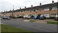
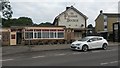

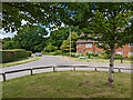
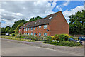
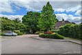
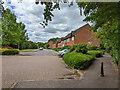
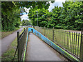
67 photos from this area
Area Information
Key information about the RH11 7PY including its size, population, and administrative classification.
- Area Type
- Postcode
- Area Size
- 1.7 hectares
- Population
- 2020
- Population Density
- 3458 people/km²
House Prices in RH11 7PY
30
Properties
£182,767
Average Sold Price
£20,000
Lowest Price
£355,000
Highest Price
Showing 30 properties
| Address | Type | Beds | Baths | Last Sale Price | Last Sale Date | |
|---|---|---|---|---|---|---|
| 39 Fitchet Close, Langley Green, Crawley, RH11 7PY | Terraced | 2 | 1 | £355,000 | May 2025 | |
| 1 Fitchet Close, Langley Green, Crawley, RH11 7PY | Retail | 2 | 1 | £335,000 | Dec 2022 | |
| 55 Fitchet Close, Langley Green, Crawley, RH11 7PY | Detached | 3 | 1 | £220,000 | Apr 2020 | |
| 57 Fitchet Close, Langley Green, Crawley, RH11 7PY | Terraced | 3 | 1 | £255,000 | May 2018 | |
| 35 Fitchet Close, Langley Green, Crawley, RH11 7PY | Terraced | 2 | 1 | £230,000 | Apr 2015 | |
| 17 Fitchet Close, Langley Green, Crawley, RH11 7PY | Terraced | 3 | 1 | £200,000 | Jan 2015 | |
| 59 Fitchet Close, Langley Green, Crawley, RH11 7PY | Terraced | 4 | - | £235,000 | Jun 2014 | |
| 53 Fitchet Close, Langley Green, Crawley, RH11 7PY | Terraced | 3 | 1 | £153,000 | Aug 2012 | |
| 43 Fitchet Close, Langley Green, Crawley, RH11 7PY | house | - | - | £145,000 | Oct 2010 | |
| 37 Fitchet Close, Langley Green, Crawley, RH11 7PY | house | - | - | £109,500 | Aug 2009 |
Page 1 of 3
Energy Efficiency in RH11 7PY
Amenities
Schools
| Rank | School | Type | Entry gender | Ages |
|---|
Explore more schools in this area
Go to Schools tabDemographics
Household Size
Family (3-5 people)
most common
Accommodation Type
Houses
most common
Tenure
65
majority
Ethnic Group
White
most common
Religion
N/A
most common
Household Composition
N/A
most common
Age
47
median
Adults (30-64 years)
most common
Household Deprivation
N/A
with no deprivation
NS-SEC
27
in Lower managerial occupations
Explore more demographic insights in this area
Go to Demographics tabPlanning
Planning Constraints
- Flood RiskPremium
- Ramsar Wetland SitesPremium
- Area of Outstanding Natural BeautyPremium
- Protected Nature ReservePremium
- Protected WoodlandPremium