Area Overview for RH11 7LR
Photos of RH11 7LR
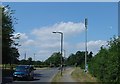
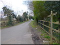
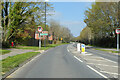
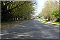
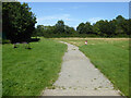
33 photos from this area
Area Information
Key information about the RH11 7LR including its size, population, and administrative classification.
- Area Type
- Postcode
- Area Size
- 1.9 hectares
- Population
- 2020
- Population Density
- 3458 people/km²
House Prices in RH11 7LR
46
Properties
£290,128
Average Sold Price
£62,000
Lowest Price
£480,000
Highest Price
Showing 46 properties
| Address | Type | Beds | Baths | Last Sale Price | Last Sale Date | |
|---|---|---|---|---|---|---|
| 24 Langley Walk, Langley Green, Crawley, RH11 7LR | Semi-detached | 4 | 2 | £425,000 | Aug 2025 | |
| 20 Langley Walk, Langley Green, Crawley, RH11 7LR | Semi-detached | 4 | 2 | £480,000 | Feb 2025 | |
| 6 Langley Walk, Langley Green, Crawley, RH11 7LR | Detached | 4 | 2 | £450,000 | Jan 2025 | |
| 54 Langley Walk, Langley Green, Crawley, RH11 7LR | Semi-detached | 3 | 1 | £430,000 | Dec 2024 | |
| 10 Langley Walk, Langley Green, Crawley, RH11 7LR | Semi-detached | 3 | 1 | £390,000 | Sep 2024 | |
| 86 Langley Walk, Langley Green, Crawley, RH11 7LR | Semi-detached | 3 | 1 | £390,000 | Mar 2024 | |
| 52 Langley Walk, Langley Green, Crawley, RH11 7LR | Retail | 3 | 1 | £416,995 | Nov 2022 | |
| 28 Langley Walk, Langley Green, Crawley, RH11 7LR | Retail | 3 | 2 | £395,000 | Apr 2022 | |
| 80 Langley Walk, Langley Green, Crawley, RH11 7LR | Semi-detached | 3 | 1 | £313,000 | Apr 2020 | |
| 2 Langley Walk, Langley Green, Crawley, RH11 7LR | Semi-detached | 4 | 2 | £330,000 | Feb 2019 |
Page 1 of 5
Energy Efficiency in RH11 7LR
Amenities
Schools
| Rank | School | Type | Entry gender | Ages |
|---|
Explore more schools in this area
Go to Schools tabDemographics
Household Size
Family (3-5 people)
most common
Accommodation Type
Houses
most common
Tenure
65
majority
Ethnic Group
White
most common
Religion
N/A
most common
Household Composition
N/A
most common
Age
47
median
Adults (30-64 years)
most common
Household Deprivation
N/A
with no deprivation
NS-SEC
27
in Lower managerial occupations
Explore more demographic insights in this area
Go to Demographics tabPlanning
Planning Constraints
- Flood RiskPremium
- Ramsar Wetland SitesPremium
- Area of Outstanding Natural BeautyPremium
- Protected Nature ReservePremium
- Protected WoodlandPremium