Area Overview for RH11 0JB
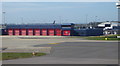
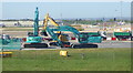
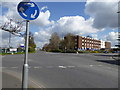
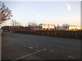
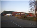
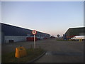
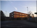
Photos of RH11 0JB

Area Information
Living in RH11 0JB means residing within a specific postcode cluster in England that functions as a small residential community. The area forms a distinct pocket of housing amidst the wider Crawley landscape. With a population of 1,786 people, this is a tightly knit neighbourhood where local interactions are more likely than in sprawling urban districts. The physical scale supports a sense of familiarity among residents, offering a quieter alternative to major cities while maintaining essential access to London's infrastructure. Households in this postcode occupy a layout primarily defined by houses rather than high-density flats. This structure suggests a preference for garden space and detached or semi-detached living arrangements. The location is strategically positioned near Gatwick Airport, placing it within close reach of significant transport hubs and retail centres. Despite its size, the area possesses clear identity markers derived from its demographic makeup and connectivity. You may find yourself navigating streets that serve both local commuters and those travelling to London Gatwick Airport Railway Station. The balance between a rural feel and urban proximity defines daily life here. It is a place where the road to the airport passes through quiet residential streets. Buyers often value this specific blend of seclusion and accessibility when searching for homes in this specific sector.
- Area Type
- Postcode
- Area Size
- Not available
- Population
- 1786
- Population Density
- 172 people/km²
The housing market in RH11 0JB is defined by a specific stock mix that mirrors the age of the residents. Houses remain the primary accommodation type, meaning buyers will find mostly detached, semi-detached, or terraced homes rather than purpose-built flats or town houses. This preference for single-family dwellings aligns with the area's median age of 47 years, as younger families and mature professionals often seek space over density. Approximately 47% of the population owns their homes, indicating that nearly half the residents have achieved a foothold in the property ladder, likely through purchase decades ago. Consequently, the rental market accounts for the remaining households, creating a dynamic where both owner-occupiers and tenants coexist. Given the small population of 1,786, every property is a significant part of the local landscape. Buyers looking at RH11 0JB should expect to compete against established owner-occupiers who have lived in their current homes for long periods. The lack of large apartment blocks simplifies the search but may limit options for those specifically seeking low-maintenance urban living. The market here is driven by the value of house sizes and garden potential rather than proximity to high-rises. When searching for homes in RH11 0JB, you will evaluate floor plans suited to families and retirees rather than investors seeking high density.
House Prices in RH11 0JB
No properties found in this postcode.
Energy Efficiency in RH11 0JB
Daily life in RH11 0JB revolves around practical amenities located just beyond the residential boundary. Residents have access to six major retail outlets, including Spar, Tesco Crawley, and M&S Acorn, which cover supermarkets and general goods needs. These shops are consistent enough to form the backbone of local shopping habits without requiring long-distance trips. Transport links further enhance lifestyle convenience, with five rail stations providing quick access to regional destinations. Gatwick Airport sits nearby as a notable amenity, serving the two passengers travelling by air. Two Metro shuttle stations connect directly to the airport terminals, making airport logistics simple. The South Terminal Coach Station offers an alternative for those travelling by road. You can easily reach London Gatwick Airport Railway Station for regional journeys or leisure travel. The presence of Tesco Crawley ensures fresh groceries without extensive travel. Five additional retail or leisure venues are clustered within practical reach, supporting a self-sufficient daily routine. This concentration of services means you can manage most errands without venturing far from RH11 0JB. The area functions as a quiet residential base with immediate access to essential commercial and transport infrastructure.
Amenities
Schools
Families considering RH11 0JB have access to two specific educational institutions listed in the local vicinity. Langley Green First School operates as a primary school, catering to younger children within this residential cluster. A distinct option for private education is available nearby through Charlwood House, which functions as an independent school. The presence of a primary school suggests that local routes are designed to support early education needs. The availability of an independent school indicates an alternative pathway for families seeking a different curriculum or ethos from the state sector. You will not find secondary schools explicitly named in the provided data for this immediate postcode, so families may rely on catchment areas in adjacent postcodes for older students. The mix of school types provides choice for households with different educational priorities. Parents might choose Langley Green First School for a local state pathway or Charlwood House for a private education model. The proximity of these venues is a key factor for anyone weighing the commute for their children. When assessing schools near RH11 0JB, you must decide between the state primary route and the independent option available immediately beyond the boundary. This educational infrastructure supports the demographic core of adults between 30 and 64 years old who are likely to be parents.
| Rank | School | Type | Entry gender | Ages |
|---|
Explore more schools in this area
Go to Schools tabDemographics
The community in RH11 0JB reflects a mature household structure with a median age of 47 years. Adults aged between 30 and 64 years constitute the most common age range, establishing a demographic core focused on family life and stable careers. This age profile indicates a settled population rather than a transient student or retirement community. Home ownership stands at 47%, showing a significant portion of residents have purchased their properties while the remainder likely reside in the rental sector. Houses form the predominant accommodation type, reinforcing the character of the neighbourhood as a traditional family setting. The predominant ethnic group recorded is White, which shapes the cultural fabric of the local shops and community groups. This homogeneity extends beyond race to include shared life stages among neighbours. While the area lacks statistically complex diversity metrics in this specific dataset, the concentration of adults suggests a stable environment for raising children. These figures paint a picture of a residential zone where long-term residents outnumber short-term renters. You are entering a community where the majority of homes are occupied by people who have put down roots. The age distribution means local businesses cater to established families rather than young singles. Understanding these demographics helps you gauge the kind of neighbours you might find down the street in this specific cluster.
Household Size
Accommodation Type
Tenure
Ethnic Group
Religion
Household Composition
Age
Household Deprivation
NS-SEC
Explore more demographic insights in this area
Go to Demographics tabPlanning
Planning Constraints
- Flood RiskPremium
- Ramsar Wetland SitesPremium
- Area of Outstanding Natural BeautyPremium
- Protected Nature ReservePremium
- Protected WoodlandPremium