Area Overview for RH11 0DG
Photos of RH11 0DG
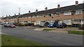
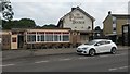
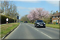
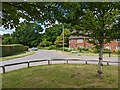
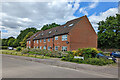
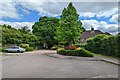
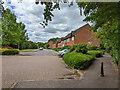
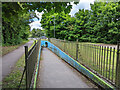
67 photos from this area
Area Information
Key information about the RH11 0DG including its size, population, and administrative classification.
- Area Type
- Postcode
- Area Size
- 6087 m²
- Population
- 1794
- Population Density
- 7277 people/km²
House Prices in RH11 0DG
14
Properties
£171,000
Average Sold Price
£118,000
Lowest Price
£225,000
Highest Price
Showing 14 properties
| Address | Type | Beds | Baths | Last Sale Price | Last Sale Date | |
|---|---|---|---|---|---|---|
| 61 Ifield Drive, Ifield, Crawley, RH11 0DG | Terraced | 1 | - | £225,000 | Feb 2014 | |
| 59 Ifield Drive, Ifield, Crawley, RH11 0DG | Terraced | - | - | £170,000 | Oct 2005 | |
| 57 Ifield Drive, Ifield, Crawley, RH11 0DG | Terraced | - | - | £118,000 | May 2002 | |
| 53 Ifield Drive, Ifield, Crawley, RH11 0DG | Terraced | 3 | 1 | - | - | |
| 55 Ifield Drive, Ifield, Crawley, RH11 0DG | Terraced | 3 | 1 | - | - | |
| 63 Ifield Drive, Ifield, Crawley, RH11 0DG | Terraced | - | - | - | - | |
| 39 Ifield Drive, Ifield, Crawley, RH11 0DG | Bungalow | - | - | - | - | |
| 37 Ifield Drive, Ifield, Crawley, RH11 0DG | Bungalow | - | - | - | - | |
| 41 Ifield Drive, Ifield, Crawley, RH11 0DG | Terraced | - | - | - | - | |
| 47 Ifield Drive, Ifield, Crawley, RH11 0DG | Bungalow | - | - | - | - |
Page 1 of 2
Energy Efficiency in RH11 0DG
Amenities
Schools
| Rank | School | Type | Entry gender | Ages |
|---|
Explore more schools in this area
Go to Schools tabDemographics
Household Size
Family (3-5 people)
most common
Accommodation Type
Houses
most common
Tenure
56
majority
Ethnic Group
White
most common
Religion
N/A
most common
Household Composition
N/A
most common
Age
47
median
Adults (30-64 years)
most common
Household Deprivation
N/A
with no deprivation
NS-SEC
26
in Lower managerial occupations
Explore more demographic insights in this area
Go to Demographics tabPlanning
Planning Constraints
- Flood RiskPremium
- Ramsar Wetland SitesPremium
- Area of Outstanding Natural BeautyPremium
- Protected Nature ReservePremium
- Protected WoodlandPremium