Area Overview for RH10 9RT
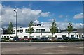
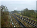
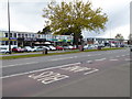
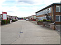
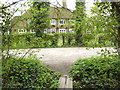
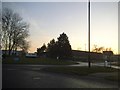
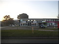
Photos of RH10 9RT
Area Information
Living in RH10 9RT means residing within a specific postcode area that covers a small residential cluster measuring 2468 square metres. You are part of a tightly knit community with a total population of 2307 people, resulting in a density of 705 individuals per square kilometre. This compact size creates a neighbourhood where services and residents are in close proximity, fostering a sense of local familiarity. The area functions as a practical residential hub, ideal for those seeking a defined community rather than sprawling developments. Daily life here revolves around the immediate convenience of reaching local shops and transport links without significant travel time. The small footprint ensures that you can walk to essential destinations, reducing reliance on vehicles for short journeys. This concentration of housing supports a lifestyle where convenience and community awareness take precedence over expansive green spaces or suburban isolation. You will find yourself surrounded by a demographic that values the efficiency of a small, managed environment. The area serves as a functional base for commuters and families who prioritise location and accessibility over vast living quarters. Understanding the scale of RH10 9RT is key to appreciating its distinct character as a focused residential zone.
- Area Type
- Postcode
- Area Size
- 2468 m²
- Population
- 2307
- Population Density
- 705 people/km²
The housing market in RH10 9RT is characterised by a predominantly flat-based stock, which distinguishes it from traditional detached house areas. With only 33% of residents owning their homes, you are navigating a landscape where rentals and buy-to-let investments appear more common than owner-occupied family homes. This statistic suggests that if you are looking to buy, competition may be higher from long-term tenants or investors seeking stable yields. The sheer majority of the housing stock consists of flats, meaning you will typically be searching for apartments or purpose-built blocks rather than detached family residences. This type of accommodation appeals to professionals, younger couples, or those who do not require large gardens. You should prepare for a market where prices might reflect the premium of location over space. The low ownership rate indicates that many properties are held by landlords who rent them out to a dynamic tenant pool. Buyers should be aware that transactions may involve leasehold considerations common with flat developments. This market structure offers convenience and accessibility but limits the availability of traditional house types. Consequently, the value proposition of living in RH10 9RT hinges heavily on the specific features of the available flats and their proximity to transport hubs.
House Prices in RH10 9RT
No properties found in this postcode.
Energy Efficiency in RH10 9RT
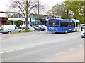
Your lifestyle in RH10 9RT extends quickly to a range of practical amenities within walking or short driving distance. For groceries, you have access to five nearby retail outlets, including a Spar, Tesco Crawley, and Tesco Poundhill. These supermarkets provide a comprehensive range of goods for daily necessities and weekly shopping trips. Transport connections are virtually on your doorstep, with five railway options readily available. Gatwick Airport Railway Station, Three Bridges Railway Station, and Horley Railway Station offer direct links to wider networks. You also benefit from two airports, both listed as London Gatwick Airport, placing major travel hubs nearby. For those needing ground transport, the South Terminal Coach Station is available, while three metro stations including Gatwick South Terminal Shuttle Station and Kingscote serve specific transit needs. This dense clustering of retail and transport means you require little effort to meet your daily requirements. You can handle most errands locally or rely on quick commutes to other parts of the region. The presence of these specific venues ensures that convenience is a constant feature of living in this postcode.
Amenities
Schools
| Rank | School | Type | Entry gender | Ages |
|---|
Explore more schools in this area
Go to Schools tabDemographics
The community within RH10 9RT reflects a mature demographic profile, dominated by adults aged between 30 and 64 years. Your neighbours will likely fall into this median age bracket of 47 years, suggesting a population that has moved beyond early career stages or parenting youngest children. With home ownership standing at 33%, a significant portion of the population rents their properties, which often reflects the local accommodation types that favour flats. This high concentration of flats aligns with the prevalence of rental arrangements, indicating that many households in RH10 9RT prefer or require flexible living arrangements. The predominant ethnic group is White, which shapes the cultural fabric of the local streets and communal interactions. You can expect a community that is largely settled and stable, given the age distribution. While specific income data is absent, the age and accommodation mix suggests a mix of professionals and retirees seeking urban convenience. The lower rate of ownership compared to typical suburban areas points to a market where investment properties or buy-to-let schemes play a substantial role. This demographic reality influences local schools, as families with school-aged children may represent a smaller portion of the total resident population than in areas with higher owner-occupancy rates.
Household Size
Accommodation Type
Tenure
Ethnic Group
Religion
Household Composition
Age
Household Deprivation
NS-SEC
Explore more demographic insights in this area
Go to Demographics tabPlanning
Planning Constraints
- Flood RiskPremium
- Ramsar Wetland SitesPremium
- Area of Outstanding Natural BeautyPremium
- Protected Nature ReservePremium
- Protected WoodlandPremium