Area Overview for RH10 8HQ
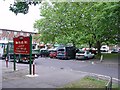
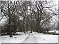
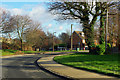
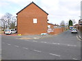
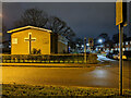
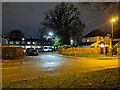
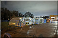
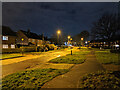
Photos of RH10 8HQ
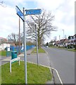
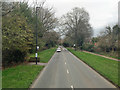
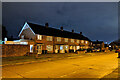
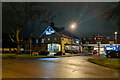
Area Information
Living in RH10 8HQ means residing within a tightly clustered postcode that covers only 9545 square metres. This small residential footprint supports a population of just over 2300 people, creating a contained environment where local knowledge and community recognition are paramount. The area is situated to provide practical access to Crawley, Three Bridges, and Ifield, positioning residents between major transport hubs and the wider Greater London area. Daily life here is defined by proximity to significant banking institutions like Sainsburys, Iceland, and Tesco, all located within practical reach of Martlets. You will find yourself surrounded by destinations that include London Gatwick Airport and the South Terminal Shuttle Station, offering convenient connections for travelers and commuters alike. The neighbourhood is compact enough that essential services are never far away, yet large enough to offer a sense of established settlement. With 705 people per square kilometre, the density is moderate, ensuring that residents benefit from typical suburban amenities without feeling trapped in high-density urban zones. This specific postcode area serves as a solid base for those seeking a location with direct links to Gatwick and the surrounding towns while maintaining a relatively low population density compared to the busiest parts of the county.
- Area Type
- Postcode
- Area Size
- 9545 m²
- Population
- 2307
- Population Density
- 705 people/km²
You are looking at a market defined by rental prevalence and specific property types. The housing stock in RH10 8HQ is characterised by flats, which accounts for the majority of the 2307 residents living there. With only 33% of the population owning their homes, this area functions much more as a rental market than an owner-occupied haven. If you are considering buying, understand that the primary demand comes from tenants and downsizers rather than families seeking detached houses. This market structure means that property prices are often tied to the demand for rental units throughout the region. The concentration of flats suggests that the land value is optimised for vertical living, typical of areas near transport links or major employment centres. Purchasing here offers entry into a community where many neighbours are likely landlords or long-term renters. For first-time buyers, this environment can present opportunities to find entry-level remainings in flats, but it also means less competition from families seeking large gardens or private gardens. You should approach the market with an understanding that this is a locality where possession rates remain stubbornly low compared to the national average for single-family homes.
House Prices in RH10 8HQ
Showing 21 properties
| Address | Type | Beds | Baths | Last Sale Price | Last Sale Date | |
|---|---|---|---|---|---|---|
| 32 Barnfield Road, Northgate, Crawley, RH10 8HQ | Semi-detached | 2 | 1 | £400,000 | Aug 2024 | |
| 22 Barnfield Road, Northgate, Crawley, RH10 8HQ | Semi-detached | 3 | 1 | £406,080 | Dec 2022 | |
| 2A Barnfield Road, Northgate, Crawley, RH10 8HQ | Terraced | 3 | 1 | £325,000 | Oct 2020 | |
| 8 Barnfield Road, Northgate, Crawley, RH10 8HQ | Terraced | 3 | 2 | £336,000 | Sep 2020 | |
| 16 Barnfield Road, Northgate, Crawley, RH10 8HQ | house | - | - | £286,000 | Jul 2018 | |
| 2 Barnfield Road, Northgate, Crawley, RH10 8HQ | house | - | - | £171,000 | Aug 2013 | |
| 36 Barnfield Road, Northgate, Crawley, RH10 8HQ | house | 3 | - | £223,500 | Jun 2011 | |
| 18 Barnfield Road, Northgate, Crawley, RH10 8HQ | Terraced | 3 | 1 | - | - | |
| 28 Barnfield Road, Northgate, Crawley, RH10 8HQ | house | - | - | - | - | |
| 12 Barnfield Road, Northgate, Crawley, RH10 8HQ | Bungalow | - | - | - | - |
Energy Efficiency in RH10 8HQ
Your lifestyle in RH10 8HQ revolves around access to major retailers and transport infrastructure. You are within easy reach of Sainsburys West and Tesco Martletts, ensuring that grocery shopping is always convenient. Iceland Crawley provides additional retail choice nearby, meaning you do not need to travel far for large supermarket trips or weekly essentials. For those who work at Gatwick, the proximity to London Gatwick Airport and the Gatwick South and North Terminal Shuttle Stations is a distinct advantage. You can walk or take short transfers to Kingscote and the South Terminal Coach Station, integrating transport into your morning and evening routines seamlessly. The presence of these five railway stations, including Crawley and Three Bridges, expands your commuting options significantly. Residents here find themselves embedded in a network that connects them to London and other Southern towns without extensive travel times. Daily life involves utilising these nearby amenities efficiently, with the ability to grab a quick meal at a local cafe before heading to the train station or returning from a day at an airport. The practicality of these connections defines the routine for anyone living in this area.
Amenities
Schools
| Rank | School | Type | Entry gender | Ages |
|---|
Explore more schools in this area
Go to Schools tabDemographics
The community in RH10 8HQ reflects the wider regional trend of an established population. The median age is 47 years, indicating a neighbourhood dominated by adults rather than young families or senior couples on fixed incomes. Most residents fall into the 30-to-64-year-old age bracket, suggesting a workforce that has likely settled down after their twenties. This demographic profile implies a community with stability and established local ties. Household composition leans heavily towards non-homeownership, with only 33% of the population owning their homes outright. This statistic suggests that the majority of residents are likely tenants or live with family, creating a dynamic where utility bills and service charges can be significant household expenses. The dominant accommodation type in this postcode is flats, which aligns with the lower homeownership rate and supports the needs of professionals and renters who value smaller, low-maintenance living spaces. The ethnic makeup is predominantly White, mirroring the traditional demographic of the South East. Understanding these figures helps potential buyers realise that this is not an area in rapid demographic flux, but one characterised by a mature, working-age population residing primarily in flat-style properties.
Household Size
Accommodation Type
Tenure
Ethnic Group
Religion
Household Composition
Age
Household Deprivation
NS-SEC
Explore more demographic insights in this area
Go to Demographics tabPlanning
Planning Constraints
- Flood RiskPremium
- Ramsar Wetland SitesPremium
- Area of Outstanding Natural BeautyPremium
- Protected Nature ReservePremium
- Protected WoodlandPremium