Area Overview for RH10 8DB
Photos of RH10 8DB
Area Information
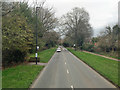
RH10 8DB represents a specific residential cluster within the postal sector, covering an area of 2.5 hectares. The postcode area accommodates a population of 2615 people, creating a densely populated neighbourhood with a density of 104946 people per square kilometre. Living in RH10 8DB means your daily routine will compress into a very small geographical footprint. This compact size means you will interact closely with your neighbours while accessing nearby facilities through short journeys. The area functions as a distinct residential pocket rather than a sprawling suburb, which defines the rhythm of life here. Residents navigate a space where footpaths and local streets suffice for most daily needs due to the sheer concentration of the population. The environment is characterised by high occupancy rates within limited land boundaries, typical of the specific postcode configuration. You are buying or renting into a micro-community where proximity is high. The small scale ensures that local events or changes affect the entire cluster noticeably. This tight-knit setting offers convenience but also lacks the vast green spaces found in larger districts. Your immediate surroundings are defined by this intense residential focus, making logistics simple and community interactions frequent.
- Area Type
- Postcode
- Area Size
- 2.5 hectares
- Population
- 2615
- Population Density
- 4034 people/km²
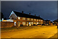
The property market in RH10 8DB is defined by a high concentration of flats, as this is the predominant accommodation type in the cluster. Only 29% of households own their homes, which means the area functions primarily as a rental destination rather than an owner-occupied marketplace. This dynamic suggests that if you are a buyer looking at properties here, you are likely completing a strata title purchase or converting a rental unit. Conversely, if you are a landlord, the high volume of flats creates a steady demand for tenanted units from the wider population. The low ownership figure of 29% indicates that the immediate surroundings may also be dominated by private or social housing blocks suited to the flat lifestyle. Density drives the market here, with 2615 people crammed into 2.5 hectares, necessitating a housing stock that maximises vertical living over single-family detached homes. You should expect a competitive environment where the majority of stock changes hands through tenancy agreements. The market reflects a practical, compact living solution rather than a family-home expansion model.
House Prices in RH10 8DB
Showing 28 properties
| Address | Type | Beds | Baths | Last Sale Price | Last Sale Date | |
|---|---|---|---|---|---|---|
| 120 Railey Road, Northgate, Crawley, RH10 8DB | Terraced | 3 | 1 | £320,000 | Feb 2025 | |
| 98 Railey Road, Northgate, Crawley, RH10 8DB | Maisonette | - | - | £270,000 | Mar 2024 | |
| 82 Railey Road, Northgate, Crawley, RH10 8DB | Terraced | 3 | 1 | £355,000 | Dec 2021 | |
| 100 Railey Road, Northgate, Crawley, RH10 8DB | Maisonette | 2 | - | £235,000 | May 2021 | |
| 124 Railey Road, Northgate, Crawley, RH10 8DB | Terraced | 3 | 1 | £325,000 | Dec 2019 | |
| 78 Railey Road, Northgate, Crawley, RH10 8DB | Terraced | 3 | - | £196,666 | May 2019 | |
| 86 Railey Road, Northgate, Crawley, RH10 8DB | house | 3 | - | £300,000 | Jun 2018 | |
| 114 Railey Road, Northgate, Crawley, RH10 8DB | Flat | 2 | - | £170,000 | Jan 2008 | |
| 122 Railey Road, Northgate, Crawley, RH10 8DB | Terraced | 3 | - | £218,000 | May 2007 | |
| 90 Railey Road, Northgate, Crawley, RH10 8DB | Terraced | 3 | 1 | £167,000 | Feb 2006 |
Energy Efficiency in RH10 8DB
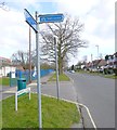
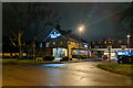
Residents of RH10 8DB enjoy immediate access to essential amenities within practical reach, despite the small size of the postcode. For your daily shopping needs, Tesco Crawley, Tesco Martletts, and Iceland Crawley are available nearby. These retailers offer a comprehensive range of groceries and household essentials without the need for travel. Transport links are extensive, with five named rail stations accessible including Crawley Railway Station, Three Bridges Railway Station, and Ifield Railway Station. You can reach these hubs quickly, facilitating easy commutes to London or other business centres. Two airports, both identified as London Gatwick Airport, lie within practical reach, providing international travel options. Additionally, three metro stations, including the Gatwick South Terminal Shuttle Station and Kingscote, serve the area for local transit. A bus connection links residents to the South Terminal Coach Station. This density of amenities ensures that your lifestyle remains convenient and well-connected to the wider region.
Amenities
Schools
Families living in RH10 8DB have access to specific educational institutions within the local cluster. Northgate Primary serves the community as a designated primary school for young children. For children with special educational needs, Manor Green College operates nearby as a special school. This combination provides a direct path for elementary education and specialist support without requiring long commutes to Crawley town centre. The presence of a primary school indicates that early childhood education is integrated into the immediate vicinity. Living in RH10 8DB means parents can rely on these two established facilities for their children's schooling. The mix of a standard primary institution and a special college caters to a range of educational requirements within the 2.5-hectare footprint. While the area hosts exceptional growth businesses, schools near RH10 8DB remain the focal point for local families. The limited but specific school options define the neighbourhood's capacity to attract young families seeking immediate educational access.
| Rank | School | Type | Entry gender | Ages |
|---|
Explore more schools in this area
Go to Schools tabDemographics
The community profile of RH10 8DB reflects an ageing demographic with a median age of 47 years. The most common age range for residents consists of adults between 30 and 64 years old, suggesting a stable lifecycle stage focused on employment and family formation. Home ownership stands at 29%, indicating that a significant majority of residents live in rental accommodation. The predominant accommodation type in the area consists of flats, aligning with the high density and rental nature of the stock. This mix creates a neighbourhood where tenants outnumber property owners, potentially influencing local investment patterns and landlord-market dynamics. The predominant ethnic group in the area identifies as White. You are entering a market where long-term tenancies may be more prevalent than owner-occupation leases. The age profile suggests a community that is currently active in the workforce yet moving towards retirement in later decades. Understanding these figures helps you gauge the type of companionship and neighbourly interaction you can expect. The high flat ownership correlates with the lower home ownership percentage, pointing to a population that relies heavily on the private rental sector for their housing needs.
Household Size
Accommodation Type
Tenure
Ethnic Group
Religion
Household Composition
Age
Household Deprivation
NS-SEC
Explore more demographic insights in this area
Go to Demographics tabPlanning
Planning Constraints
- Flood RiskPremium
- Ramsar Wetland SitesPremium
- Area of Outstanding Natural BeautyPremium
- Protected Nature ReservePremium
- Protected WoodlandPremium