Area Overview for RH10 3SN
Photos of RH10 3SN
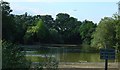
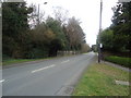
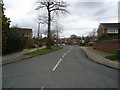
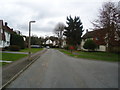
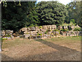
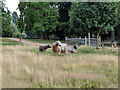
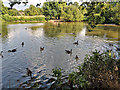
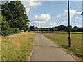
84 photos from this area
Area Information
Key information about the RH10 3SN including its size, population, and administrative classification.
- Area Type
- Postcode
- Area Size
- 1.8 hectares
- Population
- 2077
- Population Density
- 519 people/km²
House Prices in RH10 3SN
26
Properties
£276,417
Average Sold Price
£215,000
Lowest Price
£377,000
Highest Price
Showing 26 properties
| Address | Type | Beds | Baths | Last Sale Price | Last Sale Date | |
|---|---|---|---|---|---|---|
| 20 Siena Drive, Pound Hill, Crawley, RH10 3SN | Terraced | 3 | 3 | £377,000 | Aug 2025 | |
| 8 Siena Drive, Pound Hill, Crawley, RH10 3SN | Terraced | 2 | 2 | £340,000 | Sep 2024 | |
| 2 Siena Drive, Pound Hill, Crawley, RH10 3SN | Retail | 3 | 2 | £352,000 | May 2022 | |
| 5 Siena Drive, Pound Hill, Crawley, RH10 3SN | Terraced | 2 | 2 | £275,000 | Nov 2020 | |
| 26 Siena Drive, Pound Hill, Crawley, RH10 3SN | Terraced | 2 | 2 | £285,000 | Feb 2020 | |
| 14 Siena Drive, Pound Hill, Crawley, RH10 3SN | Terraced | 3 | 2 | £312,000 | Nov 2019 | |
| 9 Siena Drive, Pound Hill, Crawley, RH10 3SN | Terraced | 3 | 2 | £345,000 | Jul 2019 | |
| 18 Siena Drive, Pound Hill, Crawley, RH10 3SN | Terraced | 3 | 2 | £307,500 | May 2018 | |
| 25 Siena Drive, Pound Hill, Crawley, RH10 3SN | house | 2 | - | £291,500 | Jul 2017 | |
| 22 Siena Drive, Pound Hill, Crawley, RH10 3SN | Terraced | 3 | 3 | £306,000 | Mar 2017 |
Page 1 of 3
Energy Efficiency in RH10 3SN
Amenities
Schools
| Rank | School | Type | Entry gender | Ages |
|---|
Explore more schools in this area
Go to Schools tabDemographics
Household Size
Family (3-5 people)
most common
Accommodation Type
Houses
most common
Tenure
84
majority
Ethnic Group
White
most common
Religion
N/A
most common
Household Composition
N/A
most common
Age
47
median
Adults (30-64 years)
most common
Household Deprivation
N/A
with no deprivation
NS-SEC
43
in Lower managerial occupations
Explore more demographic insights in this area
Go to Demographics tabPlanning
Planning Constraints
- Flood RiskPremium
- Ramsar Wetland SitesPremium
- Area of Outstanding Natural BeautyPremium
- Protected Nature ReservePremium
- Protected WoodlandPremium